
Chauve Souris, Praslin
Nickname: Jeanette Island | |
|---|---|
 | |
| Geography | |
| Location | Seychelles, Indian Ocean |
| Coordinates | 4°19′48″S 55°39′48″E / 4.33000°S 55.66333°E |
| Archipelago | Inner Islands, Seychelles |
| Adjacent to | Indian Ocean |
| Administration | |
| Demographics | |
| Demonym | Creole |
| Population | 2 |
| Additional information | |
| Time zone | |
| Official website | www |
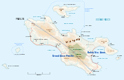
Chauve Souris is an island in Seychelles, lying 400 m northeast of the island of Praslin. Another nearby island - Saint-Pierre Island is located immediately in the north. The island is a granite island covered with tropical forest. Fauna is limited to the likes of skinks, geckoes and limited birdlife that chiefly use the island as a roost.
The island is privately owned. Chauve Souris Island has a small resort: Club Vacanze Seychelles.[1][2] There is also a Chauve Souris island near the western coast of the island of Mahe.
Tourism
Today, the island's main industry is tourism.
Image gallery
-
 Image 1
 -
 Image 2
 -
 Map 1
Map 1 -
 Map 2
Map 2 -
 Island viewed from Anse Royal on Praslin


References
Wikimedia Commons has media related to Îlot_Chauve-Souris.
This Seychelles location article is a stub. You can help Wikipedia by expanding it. |