Choirokoitia (village)
Appearance
Choirokoitia | |
|---|---|
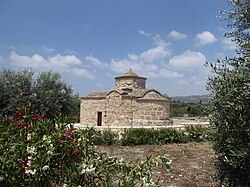
 Panagia tou Kampou, Choirokoitia | |
| Coordinates: 34°47′47″N 33°20′11″E / 34.79639°N 33.33639°E | |
| Country | |
| District | Larnaca District |
| Population (2011)[1] | |
• Total | 632 |
| Time zone | UTC+2 (EET) |
| • Summer (DST) | UTC+3 (EEST) |
Choirokoitia (Template:Lang-el; Template:Lang-tr) is a village in the Larnaca District of Cyprus, located 2 km north of Tochni, near the UN World Heritage Site of Choirokoitia.
References
- ^ "C1. POPULATION ENUMERATED BY SEX, AGE, DISTRICT, MUNICIPALITY/COMMUNITY AND QUARTER (1.10.2011)", Population - Place of Residence, 2011, Statistical Service of the Republic of Cyprus, 2014-04-17, archived from the original on 2014-04-20, retrieved 2014-04-20


