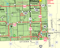
Crestline, Kansas
Appearance
Crestline, Kansas | |
|---|---|
 | |
| Coordinates: 37°10′15″N 94°42′16″W / 37.17083°N 94.70444°W[1] | |
| Country | United States |
| State | Kansas |
| County | Cherokee |
| Elevation | 869 ft (265 m) |
| Population | |
• Total | 116 |
| Time zone | UTC-6 (CST) |
| • Summer (DST) | UTC-5 (CDT) |
| ZIP code | 66728 |
| Area code | 620 |
| FIPS code | 20-16325 [1] |
| GNIS ID | 469323 [1] |
Crestline is an unincorporated community in Cherokee County, Kansas, United States.[1] As of the 2020 census, the population of the community and nearby areas was 116.[2] Crestline is located on U.S. Route 400 7.5 miles (12.1 km) east of Columbus. Crestline has a post office with ZIP code 66728.[3]
History
Crestline was a station on the St. Louis–San Francisco Railway.[4]
Demographics
| Census | Pop. | Note | %± |
|---|---|---|---|
| 2020 | 116 | — | |
| U.S. Decennial Census | |||
For statistical purposes, the United States Census Bureau has defined Crestline as a census-designated place (CDP).
References
- ^ a b c d e Geographic Names Information System (GNIS) details for Crestline, Kansas; United States Geological Survey (USGS); October 13, 1978.
- ^ a b "Profile of Crestline, Kansas (CDP) in 2020". United States Census Bureau. Archived from the original on November 9, 2022. Retrieved November 9, 2022.
- ^ "Free ZIP Code Lookup with area code, county, geocode, MSA/PMSA, population". www.zipinfo.com. Archived from the original on 2016-08-21. Retrieved 2016-09-16.
- ^ Blackmar, Frank Wilson (1912). Kansas: A Cyclopedia of State History, Embracing Events, Institutions, Industries, Counties, Cities, Towns, Prominent Persons, Etc. Standard Publishing Company. pp. 484.
Further reading
External links


