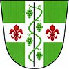
Dolenice
Dolenice | |
|---|---|
Municipality | |
| Coordinates: 48°54′13″N 16°21′16″E / 48.90361°N 16.35444°E | |
| Country | |
| Region | South Moravian |
| District | Znojmo |
| Area | |
| • Total | 4.46 km2 (1.72 sq mi) |
| Elevation | 227 m (745 ft) |
| Population (2006) | |
| • Total | 153 |
| • Density | 34/km2 (89/sq mi) |
| Postal code | 671 78 |
Dolenice (German: Tullnitz) is a village and municipality (obec) in Znojmo District in the South Moravian Region of the Czech Republic.
The municipality covers an area of 4.46 square kilometres (1.72 sq mi), and has a population of 153 (as at 3 July 2006).
Dolenice lies approximately 25 kilometres (16 mi) east of Znojmo, 39 km (24 mi) south-west of Brno, and 192 km (119 mi) south-east of Prague.
Population development
| Census year | Population | Ethnicity of inhabitants | ||
|---|---|---|---|---|
| year | German | Czechs | other | |
| 1880 | 458 | 399 | 59 | 0 |
| 1890 | 364 | 309 | 55 | 0 |
| 1900 | 360 | 309 | 51 | 0 |
| 1910 | 393 | 357 | 36 | 0 |
| 1921 | 440 | 348 | 87 | 5 |
| 1930 | 388 | 285 | 98 | 5 |
Document
- ^ Historický místopis Moravy a Slezska v letech 1848–1960, sv.9. 1984
References
Wikimedia Commons has media related to Dolenice.


