
File:1686 Mallet Map of Ceylon or Sri Lanka (Taprobane) - Geographicus - Taprobane-mallet-1686.jpg

Size of this preview: 472 × 599 pixels. Other resolutions: 189 × 240 pixels | 378 × 480 pixels | 605 × 768 pixels | 807 × 1,024 pixels | 1,602 × 2,033 pixels.
Original file (1,602 × 2,033 pixels, file size: 1 MB, MIME type: image/jpeg)
| This is a file from the Wikimedia Commons. Information from its description page there is shown below. Commons is a freely licensed media file repository. You can help. |
_-_Geographicus_-_Taprobane-mallet-1686.jpg)
| Ancienne Isle Taprobane. Die alte Insel Tabrobane. | ||||||
|---|---|---|---|---|---|---|
| Artist | ||||||
| Title |
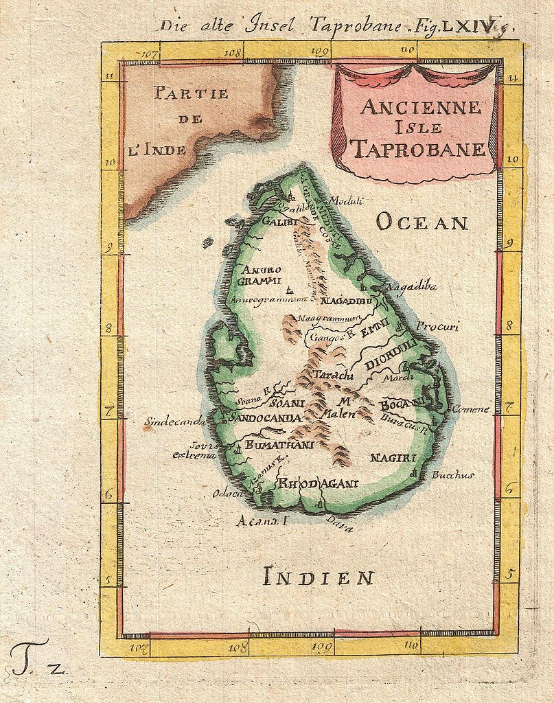
Ancienne Isle Taprobane. Die alte Insel Tabrobane. |
|||||
| Description |
English: A beautiful miniature 1683 map of Ceylon, Sri Lanka, or Taprobane by Alain Mallet. This stunning little map covers the island of Ceylon as well as parts of adjacent India. Mallet first introduced this map in the 1683 though it was republished several time in the subsequent 20 years. Taprobane is an ancient name for a spice rich trading center that was well known in ancient Roman times. By the 17th century Portuguese explorers had reopened the route to the Indies but were uncertain exactly which island the Romans were referring to. Some map Taprobrane as Sumatra, other as Ceylon. The common consensus now, as in Mallet’s time, is that the Roman Taprobane is Ceylon. Published by copper plate in the 1686 Frankfurt edition of Mallet’s Description de l'Univers. |
|||||
| Date | 1686 (undated) | |||||
| Dimensions | height: 7 in (17.7 cm); width: 5 in (12.7 cm) | |||||
| Accession number |
Geographicus link: Taprobane-mallet-1686 |
|||||
| Source/Photographer |
Mallet, A., Description de l'Univers, (Frankfurt), 1686.
|
|||||
| Permission (Reusing this file) |
|
|||||
File history
Click on a date/time to view the file as it appeared at that time.
| Date/Time | Thumbnail | Dimensions | User | Comment | |
|---|---|---|---|---|---|
| current | 22:17, 24 March 2011 | | 1,602 × 2,033 (1 MB) | BotMultichillT | {{subst:User:Multichill/Geographicus |link=http://www.geographicus.com/P/AntiqueMap/Taprobane-mallet-1686 |product_name=1686 Mallet Map of Ceylon or Sri Lanka (Taprobane) |map_title=Ancienne Isle Taprobane. Die alte Insel Tabrobane. |description=A beautif |
File usage
The following pages on the English Wikipedia use this file (pages on other projects are not listed):
- Anuradhapura period
- Beminitiya Seya
- Capital of Sri Lanka
- Cartography of Sri Lanka
- Chola conquest of Anuradhapura
- Crisis of the Sixteenth Century
- Cūḷavaṃsa
- Dīpavaṃsa
- History of Sri Lanka
- History of Sri Lanka (1948–present)
- Kandyan period
- List of wars involving Sri Lanka
- Mahāvaṃsa
- Malay invasions of Sri Lanka
- Polonnaruwa period
- Pre-Anuradhapura period
- Prehistory of Sri Lanka
- Rajavaliya
- Sri Lankan independence movement
- Transitional period of Sri Lanka
- User:Blackknight12/List of historical Sri Lankan overseas military operations
- User:Blackknight12/sandbox
- User:Lesa2006/sandbox
- User:༆/History of Asia templates
- Template:History of Sri Lanka
- Template:History of Sri Lanka/doc
Global file usage
The following other wikis use this file:
- Usage on ar.wikipedia.org
- Usage on ckb.wikipedia.org
- Usage on fa.wikipedia.org
- Usage on fi.wikipedia.org
- Usage on fr.wikipedia.org
- Usage on ja.wikipedia.org
- Usage on km.wikipedia.org
- Usage on ml.wikipedia.org
- Usage on ne.wikipedia.org
- Usage on si.wikipedia.org
_-_Geographicus_-_Taprobane-mallet-1686.jpg)