
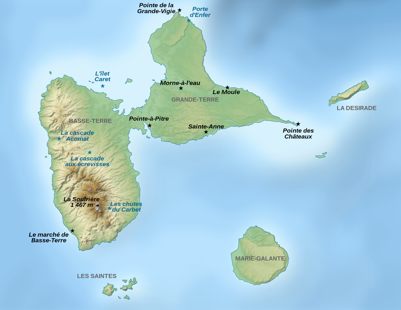
File:Guadeloupe Places of interest map-fr.svg

Size of this PNG preview of this SVG file: 776 × 600 pixels. Other resolutions: 311 × 240 pixels | 621 × 480 pixels | 994 × 768 pixels | 1,280 × 989 pixels | 2,560 × 1,978 pixels | 2,200 × 1,700 pixels.
Original file (SVG file, nominally 2,200 × 1,700 pixels, file size: 1.79 MB)
| This is a file from the Wikimedia Commons. Information from its description page there is shown below. Commons is a freely licensed media file repository. You can help. |
Summary
| Description | |||
| Date | |||
| Source |
travail personnel (own work).
Data sources:
Softwares used:
Others:
|
||
| Author | Sémhur | ||
| Other versions |
| ||
| Attribution (required by the license) | © Sémhur / Wikimedia Commons / | ||
| SVG | W3C-validity not checked.
|
||
| Graphic Lab |


| Camera location | | View this and other nearby images on: OpenStreetMap |
|---|
Licensing
I, the copyright holder of this work, hereby publish it under the following licenses:
| Copyleft: This work of art is free; you can redistribute it and/or modify it according to terms of the Free Art License. You will find a specimen of this license on the Copyleft Attitude site as well as on other sites. |
This file is licensed under the Creative Commons Attribution-Share Alike 4.0 International, 3.0 Unported, 2.5 Generic, 2.0 Generic and 1.0 Generic license.
- You are free:
- to share – to copy, distribute and transmit the work
- to remix – to adapt the work
- Under the following conditions:
- attribution – You must give appropriate credit, provide a link to the license, and indicate if changes were made. You may do so in any reasonable manner, but not in any way that suggests the licensor endorses you or your use.
- share alike – If you remix, transform, or build upon the material, you must distribute your contributions under the same or compatible license as the original.
You may select the license of your choice.
File history
Click on a date/time to view the file as it appeared at that time.
| Date/Time | Thumbnail | Dimensions | User | Comment | |
|---|---|---|---|---|---|
| current | 17:05, 7 November 2022 | | 2,200 × 1,700 (1.79 MB) | Antimuonium | moved Porte d'Enfer to its actual position |
| 19:29, 5 March 2009 |  | 2,200 × 1,700 (1.79 MB) | Sémhur | Orthograph: Marie-Galanzte => Marie-Galante | |
| 13:11, 25 September 2008 |  | 2,200 × 1,700 (1.79 MB) | Sémhur | == Description == {{Information |Description= {{en|1=Map of places of interest in Guadeloupe, a French archipelago in the Antilles.}} {{fr|1=Carte de lieux touristiques de Guadeloupe, un archipel fran |
File usage
The following pages on the English Wikipedia use this file (pages on other projects are not listed):
Global file usage
The following other wikis use this file:
- Usage on als.wikipedia.org
- Usage on es.wikipedia.org
- Usage on fr.wikipedia.org
- Usage on gl.wikipedia.org
- Usage on hu.wikipedia.org
- Usage on nl.wikipedia.org
- Usage on ro.wikipedia.org