
File:Karte gruenes deutschland.png
No higher resolution available.
Karte_gruenes_deutschland.png (188 × 235 pixels, file size: 8 KB, MIME type: image/png)
| This is a file from the Wikimedia Commons. Information from its description page there is shown below. Commons is a freely licensed media file repository. You can help. |
| Description |
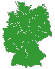
Deutsch: Karten-Icon für Navigationsleisten in Artikeln zu Deutschen Nationalparks u.ä.
English: Map icon for navigation bars for articles about German national park, etc. |
|||
| Date | ||||
| Source | Default map of Germany from opengeodb.de, reworked by bdk | |||
| Author | NN (OpenGeoDB), reworked by bdk | |||
| Permission (Reusing this file) |
This image was generated with OpenGeoDB. The information there is placed in the public domain, images generated from OpenGeoDB are derivative works without passing the threshold of creativity, they are therefore also public domain.
|
|||
| Other versions |
copied from de.wikipedia [1] 19:24, 2004-07-10 . . Bdk
|


![[1]](https://de.wikipedia.org/wiki/Bild:Karte_gruenes_deutschland.png)
File history
Click on a date/time to view the file as it appeared at that time.
| Date/Time | Thumbnail | Dimensions | User | Comment | |
|---|---|---|---|---|---|
| current | 12:55, 26 April 2006 | | 188 × 235 (8 KB) | Philippe Kurlapski | Karte "Grünes Deutschland" * '''Quelle''': Abbildungsvorlage stammt von [http://opengeodb.de/suche opengeodb.de/suche], bearbeitet von Bdk * '''Lizenz''': frei unter der GNU-FDL {{GFDL}} |
File usage
More than 100 pages use this file. The following list shows the first 100 pages that use this file only. A full list is available.
- User:Barliner/Archive1
- User:Science4sail/Talk Archive/2007 May
- User talk:2jak2jaked
- User talk:8thstar
- User talk:Aelffin
- User talk:Agathoclea/Archive 1
- User talk:Airbornelawyer
- User talk:Alex Ex
- User talk:Amwyll Rwden
- User talk:Anathemius
- User talk:Ancatdubh43
- User talk:Angleterre
- User talk:Athalis
- User talk:Athinaios
- User talk:Badbilltucker/Archive/May
- User talk:BlakeFinleyMAABD-2
- User talk:Bohater
- User talk:Bryson109/archive3
- User talk:Bulldog64
- User talk:Bundesamt
- User talk:BuzzWoof
- User talk:Cbrodersen
- User talk:Cvieg
- User talk:Daradiridatumtarides
- User talk:DaveMuadDib
- User talk:David WC2
- User talk:Demoeconomist
- User talk:DerMeister
- User talk:Deworrall
- User talk:Dojotony
- User talk:Don.Rumata~enwiki
- User talk:Donaldtownsend
- User talk:Formfaktor
- User talk:Geertjanvdk
- User talk:H-Scorpio
- User talk:Habibie
- User talk:Heidijane
- User talk:Heikoh
- User talk:Hzoi
- User talk:Jadger
- User talk:Jtgerman
- User talk:JustPippa/Archive 1
- User talk:Kingjeff/Archive1
- User talk:Krumhorns
- User talk:LUCPOL
- User talk:Langohio
- User talk:Leftfoot69
- User talk:Leopold III
- User talk:Lost Boy
- User talk:Lukedpotter
- User talk:MKLPTR
- User talk:Madmatt52
- User talk:Marco polo
- User talk:MartinSL
- User talk:Mcattell
- User talk:Me-pawel
- User talk:Meile
- User talk:Millard73
- User talk:Mistijuel
- User talk:Mkec
- User talk:Mudd1
- User talk:Nankai
- User talk:Net-net
- User talk:Net-net/Archive
- User talk:Olessi/Archive05
- User talk:Oliver Tölkes
- User talk:Panthdaman
- User talk:Patricknoddy/Archive 2
- User talk:Pavitrabaxi
- User talk:Pog451
- User talk:PubliusTacitus
- User talk:RalphRedFox
- User talk:Riper2008
- User talk:Rockford1963
- User talk:Rolf Eike Beer
- User talk:Rosenthalenglish
- User talk:RuhrFan
- User talk:Sanbeg
- User talk:Sapphire/Archive 1
- User talk:Science4sail
- User talk:SlaveToTheWage/Archive 2
- User talk:SlaveToTheWage/Archive 4
- User talk:SonicCucumber
- User talk:StarWarsGirl
- User talk:Steve9483
- User talk:SvonHalenbach
- User talk:Thegoodson
- User talk:Thw1309
- User talk:Tobi B.~enwiki
- User talk:Travissmail
- User talk:Uriel8
- User talk:Uwe Langer
- User talk:VolatileChemical
- User talk:Volck
- User talk:Wiggy!
- User talk:Willicher
- User talk:Witan
- User talk:Wood Artist
- User talk:Zephyrus67
- User talk:Zvpunry
View more links to this file.
Global file usage
The following other wikis use this file:
- Usage on de.wikipedia.org