
File:Prestolee aqueduct from riverbank.jpg

Size of this preview: 800 × 600 pixels. Other resolutions: 320 × 240 pixels | 640 × 480 pixels | 1,024 × 768 pixels | 1,280 × 960 pixels | 2,048 × 1,536 pixels.
Original file (2,048 × 1,536 pixels, file size: 1.08 MB, MIME type: image/jpeg)
| This is a file from the Wikimedia Commons. Information from its description page there is shown below. Commons is a freely licensed media file repository. You can help. |
Summary
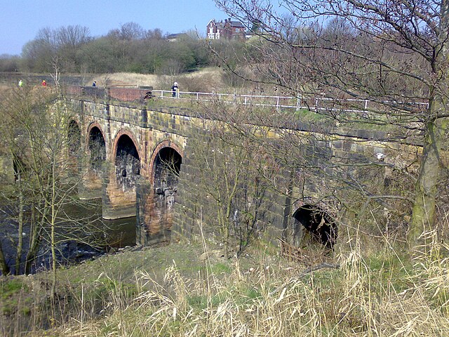
| Description | Tom Jeffs, taken on my cameraphone during Spring 2007, while working on canal bank restoration with the local society. You can make out some of the members walking across the aqueduct. The house at the top of the image overlooks the canal as it passes Nob End (where the canal is currently breached) and heads toward Bolton. |
| Source | Own work |
| Author | Parrot of Doom |
| Camera location | | View this and other nearby images on: OpenStreetMap |
|---|
Licensing
| This work has been released into the public domain by its author, I, Parrot of Doom. This applies worldwide. In some countries this may not be legally possible; if so: I, Parrot of Doom grants anyone the right to use this work for any purpose, without any conditions, unless such conditions are required by law. |
File history
Click on a date/time to view the file as it appeared at that time.
| Date/Time | Thumbnail | Dimensions | User | Comment | |
|---|---|---|---|---|---|
| current | 13:48, 14 July 2007 | | 2,048 × 1,536 (1.08 MB) | Parrot of Doom | {{Information |Description=Tom Jeffs, taken on my cameraphone during Spring 2007, while working on canal bank restoration with the local society |Source=self-made |Date= |Author= Parrot of Doom }} [[Category:Canal aqueducts in the |
File usage
The following pages on the English Wikipedia use this file (pages on other projects are not listed):