Ptelea railway station
| General information | |||||||||||
|---|---|---|---|---|---|---|---|---|---|---|---|
| Location | Ptelea Evros Greece | ||||||||||
| Coordinates | 41°43′03″N 26°15′13″E / 41.7175755°N 26.2537136°E | ||||||||||
| Owned by | GAIAOSE[1] | ||||||||||
| Line(s) | Alexandroupoli–Svilengrad railway[2] | ||||||||||
| Platforms | 2 | ||||||||||
| Tracks | 2 | ||||||||||
| Train operators | TrainOSE | ||||||||||
| Construction | |||||||||||
| Structure type | at-grade | ||||||||||
| Platform levels | 1 | ||||||||||
| Parking | No | ||||||||||
| Bicycle facilities | No | ||||||||||
| Accessible | |||||||||||
| Other information | |||||||||||
| Status | Unstaffed | ||||||||||
| Website | https://www.ose.gr/en/ | ||||||||||
| History | |||||||||||
| Electrified | No | ||||||||||
| Services | |||||||||||
| |||||||||||
| |||||||||||
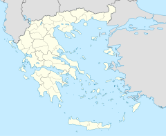
Ptelea railway stop (Template:Lang-el) is a railway stop situated halfway between Dikaia and Ormenio that serves the nearby village of Ptelea, Evros, in Eastern Macedonia and Thrace, Greece.[3] Located 2.3 kilometres (1.4 mi) north of the center of Ptelea (now part of OSE). Today TrainOSE operates just 4 daily Regional trains[4] to Alexandroupoli. The stop is unstaffed[3]
History
During World War I the railway was an important link as the Ottoman Empire, Bulgaria and Austria-Hungary were all Central Allies. Following the defeat of the Ottoman Empire, its remaining imperial possessions were divided. The sections from Alexandroupoli to Svilengrad, except for a short section of about 10 kilometres (6.2 mi)[5] in Turkey serving Edirne Karaagaç station and for 3 kilometres (1.9 mi) between the Greek border and Svilengrad station in Bulgaria[6] come under the control of the French-Hellenic Railway Company (CFFH), a subsidiary of the CO, when the CFFH was incorporated in July 1929.
Under the Treaty of Lausanne of 1923, a new border between Greece and Turkey was established at the Evros river, just east of Ftelia railway station, which had the result that the railway from Istanbul to Bulgaria entered Greece at Pythio, then re-entered Turkey at Edirne (Karaağaç railway station), re-entered Greece at Marasia, and finally entered Bulgaria between Ormenio and Svilengrad. This arrangement continued until 1971, when two new lines were opened. In Turkey, the Edirne Cut-off was opened to allow trains from Istanbul to Bulgaria to run through Edirne entirely on Turkish territory, so that trains such as the Orient Express no longer passed through Feres. In Greece, a line was opened to allow trains from Pythio to Bulgaria to stay on Greek territory and avoid Edirne. In 1954 the CFFH was absorbed by the Hellenic State Railways. In 1971, the Hellenic State Railways was reorganised into the OSE[7] taking over responsibilities for most for Greece's rail infrastructure.
In the 1990s, OSE introduced the InterCity service to the Alexandroupoli–Svilengrad line[8] Which reduced travel times across the whole line.
In 2020 it was announced that section of line between Pythio and Ormenio was to be upgraded, at a cost of €1.4 million as part of an ambitious integrated intergovernmental transport plan which will see this, and 39 other transport sector projects be built, with financing from the European Commission with a total of €117 million.[9] The package of measures aims to build or improve transport connections and connectivity across Europe, with a focus on sustainable transport. The project for the Pythian-Ormenio section envisions upgrading the existing line infrastructure and trackbed, doubling of the track as well as the installation of electrification signalling (ETCS Level 1) along the entire stretch, with the aim of improving freight transport with Bulgaria and Turkey.[10]
Facilities
The station has no facilities. The platforms have no outside seating, Dot-matrix display departure and arrival screens or timetable poster boards for passenger information, and the station remains little more than an unstaffed halt.[3]
Services
As of 2020[update], the stop is only served by one daily pair of regional trains Alexandroupoli–Ormenio.[3] There are currently no services to Svilengrad.
line layout
| L Ground/Concourse |
Exits | |
| Level Ε1 |
Side platform, doors will open on the right | |
| Platform 1 | ||
| Island platform, doors on the left | ||
| Platform 1 | ||
References
- ^ "Home". gaiaose.com.
- ^ "OSE - 2017 Network Statement Annexes".
- ^ a b c d Myrtsidis, Diamantis (2021). Η Ιστορία του Σιδηροδρόμου στον Έβρο (The History of Evros Railway) (in greek) (2nd ed.). Nea Vyssa: Myrtsidis. pp. 231–232. ISBN 978-618-00-3174-4.
- ^ "Δρομολόγια ΤΡΑΙΝΟΣΕ".
- ^ Modern measurement done on www.Openstreetmap.com indicate 10.2 km
- ^ Le Journal des chemins de fer, des mines et des TP, Paris, 29 March 1930 (in French)
- ^ Law 674/1971, Government Gazette A-192/1970
- ^ "Επειδή τα τραίνα είναι γεμάτα ανθρώπους και ιστορίες και όχι μόνο εισιτήρια και αριθμούς…". 18 January 2018.
- ^ "Αναβαθμίζεται η σιδηροδρομική γραμμή Ορμενίου - Πυθίου". v4.deltatv.gr. Retrieved 5 January 2020.
- ^ "Upgrading of Ormenio – Alexandroupoli / Frontier with Bulgaria – ΕΡΓΟΣΕ". ergose.gr. Retrieved 5 January 2020.

