Füzesgyarmat
Appearance
Füzesgyarmat | |
|---|---|
 Town hall | |
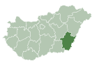
| Coordinates: 47°06′22″N 21°12′43″E / 47.106°N 21.212°E | |
| Country | |
| County | Békés |
| District | Szeghalom |
| Area | |
| • Total | 127.41 km2 (49.19 sq mi) |
| Population (2015) | |
| • Total | 5,774[1] |
| • Density | 45.3/km2 (117/sq mi) |
| Time zone | UTC+1 (CET) |
| • Summer (DST) | UTC+2 (CEST) |
| Postal code | 5525 |
| Area code | (+36) 66 |
| Website | www |
Füzesgyarmat is a town in Békés county, in the Southern Great Plain region of south-east Hungary.
History
[edit]The jewish community
[edit]A Jewish community lived in the village from the beginning of the 19th century until it was destroyed by the Nazis during the Holocaust. In 1880 there were 171 Jews in the place and by 1930 already 230 lived there. A synagogue was built in 1929 and it exists to this day and serves as a school.[2]
Geography
[edit]It covers an area of 127.41 km2 and has a population of 5774 people (2014).[1]
Sport
[edit]- Füzesgyarmati SK, association football club
Twin towns – sister cities
[edit]Füzesgyarmat is twinned with:
 Ojdula, Romania
 Zimandu Nou, Romania
References
[edit]- ^ a b Gazetteer of Hungary, 1st January 2015. Hungarian Central Statistical Office. 3 September 2015
- ^ The Jewish Community of Fuzesgyarmat in The Museum of The Jewish People website
External links
[edit]Wikimedia Commons has media related to Füzesgyarmat.
- Official website in Hungarian
47°06′N 21°13′E / 47.100°N 21.217°E


