
Hermeskeil
Hermeskeil | |
|---|---|
 | |
 Coat of arms | |
Location of Hermeskeil within Trier-Saarburg district 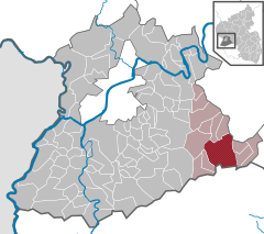 | |
 Hermeskeil  Hermeskeil | |
| Coordinates: 49°39′26″N 6°56′56″E / 49.65722°N 6.94889°E | |
| Country | Germany |
| State | Rhineland-Palatinate |
| District | Trier-Saarburg |
| Municipal assoc. | Hermeskeil |
| Subdivisions | 3 |
| Government | |
| • Mayor (2019–24) | Lena Weber[1] (SPD) |
| Area | |
| • Total | 30.85 km2 (11.91 sq mi) |
| Elevation | 540 m (1,770 ft) |
| Population (2022-12-31)[2] | |
| • Total | 8,013 |
| • Density | 260/km2 (670/sq mi) |
| Time zone | UTC+01:00 (CET) |
| • Summer (DST) | UTC+02:00 (CEST) |
| Postal codes | 54411 |
| Dialling codes | 06503 |
| Vehicle registration | TR |
| Website | www.hermeskeil.de |
Hermeskeil (German pronunciation: [ˈhɛʁməskaɪl]) is a city in the Trier-Saarburg district, in Rhineland-Palatinate, Germany. It is situated in the Hunsrück, approx. 25 km southeast of Trier. Its population is about 5,900.
Data[edit]
Hermeskeil is the seat of the Verbandsgemeinde ("collective municipality") Hermeskeil.
The old locomotive depot, Bahnbetriebswerk Hermeskeil is now a museum housing German steam engines.
The Flugausstellung aircraft museum displays more than 100 aircraft and is the largest private museum of that kind in Europe.
A Gaulish burial of the 1st century AD was discovered in a field near Hermeskeil in 2009.[3]
A Roman castrum has been identified in 2015: it is the only castrum created by Julius Caesar inside Magna Germania, when he crossed the Rhine river in 53 BC[4]
Wikipedia links[edit]
- (in German) Link to German page Hermeskeil
- (in German) Link to information page about Flugausstellung aircraft museum
- (in German) de:Römerlager Hermeskeil
References[edit]
- ^ Direktwahlen 2019, Landkreis Trier-Saarburg, Landeswahlleiter Rheinland-Pfalz, accessed 2 August 2021.
- ^ "Bevölkerungsstand 2022, Kreise, Gemeinden, Verbandsgemeinden" (PDF) (in German). Statistisches Landesamt Rheinland-Pfalz. 2023.
- ^ Axel Munsteiner, Sensationeller Fund im Ringgraben, 30 September 2009.
- ^ Archaeologists find oldest Roman fort inside Germany
External links[edit]

| International | |
|---|---|
| National | |
| Geographic | |
This Trier-Saarburg location article is a stub. You can help Wikipedia by expanding it. |