
Hollenberg, Kansas
Hollenberg, Kansas | |
|---|---|
 Location within Washington County and Kansas | |
 | |
| Coordinates: 39°58′52″N 96°59′31″W / 39.98111°N 96.99194°W[1] | |
| Country | United States |
| State | Kansas |
| County | Washington |
| Founded | 1872 |
| Platted | 1872 |
| Incorporated | 1937 |
| Named for | G.H. Hollenberg |
| Area | |
| • Total | 0.07 sq mi (0.19 km2) |
| • Land | 0.07 sq mi (0.19 km2) |
| • Water | 0.00 sq mi (0.00 km2) |
| Elevation | 1,309 ft (399 m) |
| Population | |
| • Total | 10 |
| • Density | 140/sq mi (53/km2) |
| Time zone | UTC-6 (CST) |
| • Summer (DST) | UTC-5 (CDT) |
| ZIP code | 66946 |
| Area code | 785 |
| FIPS code | 20-32650 |
| GNIS ID | 2394403[1] |
Hollenberg is a city in Washington County, Kansas, United States.[1] As of the 2020 census, the population of the city was 10.[3] It is located 1.5 miles south of the Nebraska state line.
History
[edit]Hollenberg was laid out in 1872. It was named for its founder, G. H. Hollenberg, who owned a store at the site.[4]
The first post office in Hollenberg was established in April 1872.[5]
Geography
[edit]According to the United States Census Bureau, the city has a total area of 0.08 square miles (0.21 km2), all of it land.[6] The community is approximately 1.5 miles (2.4 km) south of the Kansas-Nebraska state line.
Demographics
[edit]| Census | Pop. | Note | %± |
|---|---|---|---|
| 1940 | 128 | — | |
| 1950 | 97 | −24.2% | |
| 1960 | 55 | −43.3% | |
| 1970 | 47 | −14.5% | |
| 1980 | 57 | 21.3% | |
| 1990 | 28 | −50.9% | |
| 2000 | 31 | 10.7% | |
| 2010 | 21 | −32.3% | |
| 2020 | 10 | −52.4% | |
| U.S. Decennial Census | |||
2020 census
[edit]The 2020 United States census counted 10 people, 5 households, and 0 families in Hollenberg.[7][8] The population density was 137.0 per square mile (52.9/km2). There were 15 housing units at an average density of 205.5 per square mile (79.3/km2).[8][9] The racial makeup was 90.0% (9) white or European American (90.0% non-Hispanic white), 0.0% (0) black or African-American, 0.0% (0) Native American or Alaska Native, 0.0% (0) Asian, 0.0% (0) Pacific Islander or Native Hawaiian, 0.0% (0) from other races, and 10.0% (1) from two or more races.[10] Hispanic or Latino of any race was 0.0% (0) of the population.[11]
Of the 5 households, 0.0% had children under the age of 18; 0.0% were married couples living together; 60.0% had a female householder with no spouse or partner present. 100.0% of households consisted of individuals and 40.0% had someone living alone who was 65 years of age or older.[8] The average household size was 1.2 and the average family size was 2.0.[12] The percent of those with a bachelor’s degree or higher was estimated to be 0.0% of the population.[13]
10.0% of the population was under the age of 18, 10.0% from 18 to 24, 20.0% from 25 to 44, 20.0% from 45 to 64, and 40.0% who were 65 years of age or older. The median age was 52.5 years. For every 100 females, there were 66.7 males.[8] For every 100 females ages 18 and older, there were 80.0 males.[8]
2010 census
[edit]As of the census[14] of 2010, there were 21 people, 12 households, and 4 families residing in the city. The population density was 262.5 inhabitants per square mile (101.4/km2). There were 23 housing units at an average density of 287.5 per square mile (111.0/km2). The racial makeup of the city was 90.5% White, 4.8% from other races, and 4.8% from two or more races. Hispanic or Latino of any race were 4.8% of the population.
There were 12 households, of which 8.3% had children under the age of 18 living with them, 33.3% were married couples living together, and 66.7% were non-families. 50.0% of all households were made up of individuals. The average household size was 1.75 and the average family size was 2.75.
The median age in the city was 55.3 years. 9.5% of residents were under the age of 18; 0.0% were between the ages of 18 and 24; 9.6% were from 25 to 44; 71.4% were from 45 to 64; and 9.5% were 65 years of age or older. The gender makeup of the city was 52.4% male and 47.6% female.
2000 census
[edit]As of the census[15] of 2000, there were 31 people, 18 households, and 7 families residing in the city. The population density was 381.5 inhabitants per square mile (147.3/km2). There were 28 housing units at an average density of 344.6 per square mile (133.1/km2). The racial makeup of the city was 96.77% White, 3.23% from other races. Hispanic or Latino of any race were 3.23% of the population.
There were 18 households, out of which 16.7% had children under the age of 18 living with them, 27.8% were married couples living together, 5.6% had a female householder with no husband present, and 61.1% were non-families. 50.0% of all households were made up of individuals, and 11.1% had someone living alone who was 65 years of age or older. The average household size was 1.72 and the average family size was 2.43.
In the city, the population was spread out, with 12.9% under the age of 18, 3.2% from 18 to 24, 16.1% from 25 to 44, 48.4% from 45 to 64, and 19.4% who were 65 years of age or older. The median age was 52 years. For every 100 females, there were 106.7 males. For every 100 females age 18 and over, there were 125.0 males.
The median income for a household in the city was $11,667, and the median income for a family was $52,083. Males had a median income of $36,875 versus $16,250 for females. The per capita income for the city was $13,143. There were no families and 14.3% of the population living below the poverty line, including no under eighteens and 100.0% of those over 64.
Education
[edit]The community and nearby rural areas are served by Barnes–Hanover–Linn USD 223 public school district.
Hollenberg High School was closed through school unification. The Hollenberg High School mascot was Pirates.
References
[edit]- ^ a b c d U.S. Geological Survey Geographic Names Information System: Hollenberg, Kansas
- ^ "2019 U.S. Gazetteer Files". United States Census Bureau. Retrieved July 24, 2020.
- ^ a b "Profile of Hollenberg, Kansas in 2020". United States Census Bureau. Archived from the original on April 24, 2022. Retrieved April 24, 2022.
- ^ Blackmar, Frank Wilson (1912). Kansas: A Cyclopedia of State History, Embracing Events, Institutions, Industries, Counties, Cities, Towns, Prominent Persons, Etc. Standard Publishing Company. pp. 863.
- ^ "Kansas Post Offices, 1828-1961". Kansas Historical Society. Archived from the original on October 9, 2013. Retrieved June 27, 2014.
- ^ "US Gazetteer files 2010". United States Census Bureau. Archived from the original on January 25, 2012. Retrieved July 6, 2012.
- ^ "US Census Bureau, Table P16: HOUSEHOLD TYPE". data.census.gov. Retrieved January 16, 2024.
- ^ a b c d e "US Census Bureau, Table DP1: PROFILE OF GENERAL POPULATION AND HOUSING CHARACTERISTICS". data.census.gov. Retrieved January 16, 2024.
- ^ Bureau, US Census. "Gazetteer Files". Census.gov. Retrieved December 30, 2023.
{{cite web}}:|last=has generic name (help) - ^ "US Census Bureau, Table P1: RACE". data.census.gov. Retrieved January 16, 2024.
- ^ "US Census Bureau, Table P2: HISPANIC OR LATINO, AND NOT HISPANIC OR LATINO BY RACE". data.census.gov. Retrieved January 16, 2024.
- ^ "US Census Bureau, Table S1101: HOUSEHOLDS AND FAMILIES". data.census.gov. Retrieved January 16, 2024.
- ^ "US Census Bureau, Table S1501: EDUCATIONAL ATTAINMENT". data.census.gov. Retrieved January 16, 2024.
- ^ "U.S. Census website". United States Census Bureau. Retrieved July 6, 2012.
- ^ "U.S. Census website". United States Census Bureau. Retrieved January 31, 2008.
Further reading
[edit]External links
[edit]Municipalities and communities of Washington County, Kansas, United States | ||
|---|---|---|
| Cities | 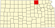 | |
| Unincorporated community | ||
| Ghost town | ||
| Townships |
| |
| Footnotes | ‡This community also has portions in an adjacent county or counties. | |