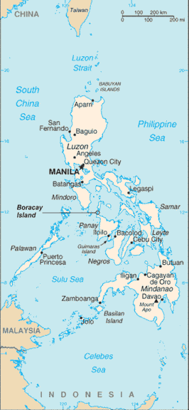
File:RPmap+Boracay.gif
Appearance
RPmap+Boracay.gif (266 × 576 pixels, file size: 19 KB, MIME type: image/gif)
File history
Click on a date/time to view the file as it appeared at that time.
| Date/Time | Thumbnail | Dimensions | User | Comment | |
|---|---|---|---|---|---|
| current | 02:03, 15 July 2006 |  | 266 × 576 (19 KB) | Wtmitchell | Philippine map with location of Boracay Island indicated Philippine map sourced from CIA World Factbook (Public Domain) Boracay Island indication added by myself |
File usage
No pages on the English Wikipedia use this file (pages on other projects are not listed).
Global file usage
The following other wikis use this file:
- Usage on no.wikipedia.org
- Usage on pam.wikipedia.org
- Usage on pl.wikipedia.org
- Usage on sv.wikipedia.org


