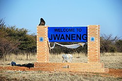
Jwaneng
Appearance
Jwaneng | |
|---|---|
Town | |
 | |
| Coordinates: 24°36′07″S 24°43′42″E / 24.60194°S 24.72833°E | |
| Country | Botswana |
| District | Southern District |
| Elevation | 1,189 m (3,901 ft) |
| Population (2022)[1] | |
| • Total | 18,784 |
| Time zone | GMT +2 |
| Climate | BSh |
Jwaneng is a town located in the Southern District of Botswana, but it is not part of this, being a separate district, with its own Town Council.[2]
History
The town was formed around the Jwaneng diamond mine, considered the richest in the world in terms of its content of gem-quality diamonds. At its inception it was a 'closed town', meaning that in order to live there permission was needed from the owners of the mine, Debswana.
In 2015, Jwaneng had 13,162 residents. It was identified as the second richest village in Botswana, with a poverty rate of less than 3%.[3]
Transportation
The town and the mine are served by the Jwaneng Airport.
References
- ^ "Statistics Bostwana - Census 2022 - Population of cities, towns and villages" (PDF).
- ^ Laws of Botswana Archived 2011-07-23 at the Wayback Machine, Ministry of Local Government Archived 2009-07-18 at the Wayback Machine
- ^ Mguni, Mbongeni (5 June 2015). "Botswana's poorest village is..." Mmegi Online. Retrieved 18 November 2018.

