Karahan Tepe
 | |
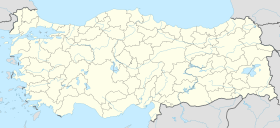
| Location | Karahan Tepe, Şanlıurfa Province, Turkey |
|---|---|
| Coordinates | 37°05′31″N 39°18′05″E / 37.09194°N 39.30139°E |
| History | |
| Periods | Pre-Pottery Neolithic A to B |
Karahan Tepe is an archaeological site in Şanlıurfa Province in Turkey. The site is close to Göbekli Tepe and archaeologists have also uncovered T-shaped stelae there. According to Daily Sabah, "The excavations have uncovered 250 obelisks featuring animal figures" as of 2020[update].[1][2]
The site is located near Yağmurlu and roughly 46 kilometers east of Göbekli Tepe, which is often called its sister site.[3][4][5] It is part of the Göbeklitepe Culture and Karahantepe Excavations project. The area is known as “Keçilitepe” by local people. It is part of a region of similar sites now being uncovered known as the Taş Tepeler.[6][2]
History
The ancient structures at Karahan Tepe were discovered in 1997 by "researchers near the Kargalı neighborhood in the Tek Tek Mountains National Park."[7]
Necmi Karul, an archeologist at Istanbul University, told Anadolu Agency in 2019, “Last year, excavation work restarted in Karahantepe [Kectepe] – around 60 km from where Göbeklitepe is located – and we encountered traces of special structures, obelisks, animal sculptures, and descriptions as well as similar symbolism”.[8] The site was filled with dirt and rubble at some point, preserving T-topped columns carved into bedrock.[9] These structures have been described as 'phallic totems'.[2]
Site
In Karahantepe, the archaeological fills cover an area of almost 10 hectares, which increases by another five hectares if the quarries for the T-shaped columns are included.[10]
References
- ^ Agency, Demirören News (2020-11-27). "New Karahantepe settlement may be older than Göbeklitepe". Daily Sabah. Retrieved 2020-12-07.
- ^ a b c Thomas, Sean. "Is an unknown, extraordinarily ancient civilisation buried under eastern Turkey? | The Spectator". www.spectator.co.uk. Retrieved 2022-05-24.
- ^ Thomas, Sean. "Is an unknown, extraordinarily ancient civilisation buried under eastern Turkey? | The Spectator". www.spectator.co.uk. Retrieved 2022-05-27.
- ^ Spray, Aaron (2021-10-31). "Karahan Tepe is Called The 'Sister Site' Of Gobekli Tepe In Turkey (And Is Just As Old)". TheTravel. Retrieved 2022-05-27.
- ^ Collins, Andrew. "Karahan Tepe: Göbekli Tepe's Sister Site - Another Temple of the Stars?".
{{cite journal}}: Cite journal requires|journal=(help) - ^ "Karahantepe on way to be new face of Turkey". Hürriyet Daily News. Retrieved 2020-12-07.
- ^ "Karahantepe excavations start in Şanlıurfa". Hürriyet Daily News. Retrieved 2020-12-07.
- ^ . The site was preserved in part by being filled in with dirt and rubble at some point preserving columns and carvings such as a large human face.Kazanci, Handan (8 March 2020). "Turkey: Conservation, not excavation, focus in Gobeklitepe". Anadolu Agency.
{{cite web}}: CS1 maint: url-status (link) - ^ https://arkeolojidergisi.ktb.gov.tr/TR-273118/yayin-arsivi.html
- ^ Karul, Necmi (2021). "Buried Buildings at Pre Pottery Neolithic Karahantepe / Karahantepe Çanak-Çömleksiz Neolitik Dönem Gömü Yapıları 2021". Türk Arkeoloji ve Etnografya Dergisi 86 (86): 22. ISSN 1302-9231.
Further reading
- Thomas, Sean (8 May 2022). "Is an unknown, extraordinarily ancient civilisation buried under eastern Turkey?". The Spectator.
- JUDITH SUDILOVSKY, 2022, "Oldest Neolithic settlements in Turkey redefine domestication, society" The Jerusalem Post, 27 May 2022: https://www.jpost.com/archaeology/article-707792
- Tells (archaeology)
- 1997 archaeological discoveries
- Archaeological sites in Southeastern Anatolia
- Archaeological sites of prehistoric Anatolia
- Buildings and structures in Şanlıurfa Province
- History of Şanlıurfa Province
- Lost ancient cities and towns
- Megalithic monuments in the Middle East
- Neolithic sites of Asia
- Prehistoric art in Turkey
- Prehistoric Anatolia
- Archaeology stubs


