
Koghb, Armenia
41°10′59″N 44°58′22″E / 41.18306°N 44.97278°E
Koghb
Կողբ | |
|---|---|
 A view of Koghb | |
 Koghb  Koghb | |
| Coordinates: 41°10′57″N 44°58′33″E / 41.18250°N 44.97583°E | |
| Country | Armenia |
| Province | Tavush |
| Municipality | Noyemberyan |
| Elevation | 750 m (2,460 ft) |
| Population | |
| • Total | 4,420 |
| Time zone | UTC+4 (AMT) |
| Website | http://www.koghb.am/ |
| Koghb, Armenia at GEOnet Names Server | |
Koghb (Armenian: Կողբ) is a village and rural community in the Noyemberyan Municipality of the Tavush Province of Armenia, located near the town of Noyemberyan.
Historical heritage[edit]
Koghb has many religious heritage sites, including the Mshkavank Monastery located on a mountain 3–4 km southwest of the village, which contains a restored 5th-century St. Astvatsatsin Church, the 5th-6th-century Tsghakhach Church, the 6th-century Tvarageghtsi Church and a 12th-13th century cemetery. Northwest of Koghb are the ruins of the Surb Arakel shrine in the old Arakelots village.[2]
There are also many forts in the vicinity of the village, including, the Berdategh cyclopean fort 1.5 km to the southeast, and the fort of Gharanots Gol close by. 10 km west of Koghb are two cyclopean forts, Zikurati and Kozmani, with Bronze Age tomb fields adjacent. 15 km west is the Patashar cyclopean fort.[2]
Gallery[edit]
-
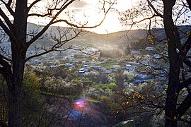
 Scenery around Koghb
 -
 Mshkavank Monastery
 -
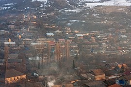 A view of Koghb
 -
 St. John the Evangelist Church
 -
 A view of Koghb
 -
 A view of Koghb
 -
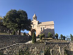 St. Lusavorich Church


References[edit]
- ^ Statistical Committee of Armenia. "The results of the 2011 Population Census of Armenia" (PDF).
- ^ a b Kiesling, Brady; Kojian, Raffi (2019). Rediscovering Armenia: An in-depth inventory of villages and monuments in Armenia and Artsakh (3rd ed.). Armeniapedia Publishing.
External links[edit]
- Koghb Art School
- Report of the results of the 2001 Armenian Census, Statistical Committee of Armenia
- Kiesling, Brady (June 2000). Rediscovering Armenia: An Archaeological/Touristic Gazetteer and Map Set for the Historical Monuments of Armenia (PDF). Archived (PDF) from the original on 6 November 2021.
