
List of lighthouses in Argentina
This is a list of lighthouses in Argentina.[1][2][3][4][5]
Lighthouses
| Name | Image | Year built |
Location & coordinates |
Class of Light [1] |
Focal height [1] |
Admiralty number [1] |
NGA number [1] |
Range nml [1] |
|---|---|---|---|---|---|---|---|---|
| Almirante Brown Lighthouse | Image | 1949 | Valdes Peninsula 42°13′03″S 64°15′29″W / 42.217631°S 64.257975°W |
Fl (2) W 16s. | 76 metres (249 ft) | G1049 | 19640 | 10 nautical miles (19 km; 12 mi) |
| Año Nuevo Lighthouse |  |
1902 | Isla Observatorio 54°39′29″S 64°07′57″W / 54.657994°S 64.132427°W |
Fl (3) W 32s. | 65 metres (213 ft) | G1279 | 20268 | 13 nautical miles (24 km; 15 mi) |
| Bahía San Gregorio Lighthouse | Image | 1968 | Florentino Ameghino Department 45°01′29″S 65°37′45″W / 45.024713°S 65.629272°W |
Fl W 5.2s. | 172 metres (564 ft) | G1089.4 | 19764 | 9 nautical miles (17 km; 10 mi) |
| Beauvoir Lighthouse |  |
1980 | Puerto Deseado 47°45′11″S 65°53′33″W / 47.752938°S 65.892631°W |
Fl W 4s. | 48 metres (157 ft) | G1139 | 19920 | 19 nautical miles (35 km; 22 mi) |
| Cabo Aristizábal Lighthouse | Image | 1977 | Escalante Department 45°12′57″S 66°31′41″W / 45.215965°S 66.527994°W |
Fl W 5s. | 46 metres (151 ft) | G1097 | 19788 | 11 nautical miles (20 km; 13 mi) |
| Cabo Blanco Lighthouse |  |
1917 | Santa Cruz Province 47°12′08″S 65°44′19″W / 47.202342°S 65.738473°W |
Fl (5) W 40s. | 67 metres (220 ft) | G1134 | 19912 | 14 nautical miles (26 km; 16 mi) |
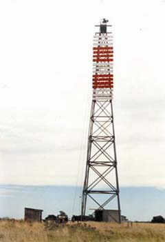
| Cabo Corrientes Lighthouse | Image | n/a | Mar del Plata 38°01′04″S 57°31′32″W / 38.017652°S 57.525519°W |
Fl W 10s. | 75 metres (246 ft) | G0915 | 19436 | 10 nautical miles (19 km; 12 mi) |
| Cabo Curioso Lighthouse | Image | 1922 | Puerto San Julián 49°11′02″S 67°37′06″W / 49.183846°S 67.618287°W |
Fl (3) W 45s. | 92 metres (302 ft) | G1162 | 19964 | 14 nautical miles (26 km; 16 mi) |
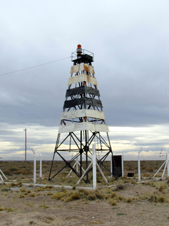
| Cabo Dañoso Lighthouse | Image | 1947 | Puerto San Julián 48°48′41″S 67°12′19″W / 48.811485°S 67.205397°W |
Fl (4) W 45s. | 44 metres (144 ft) | G1160 | 19960 | 10 nautical miles (19 km; 12 mi) |
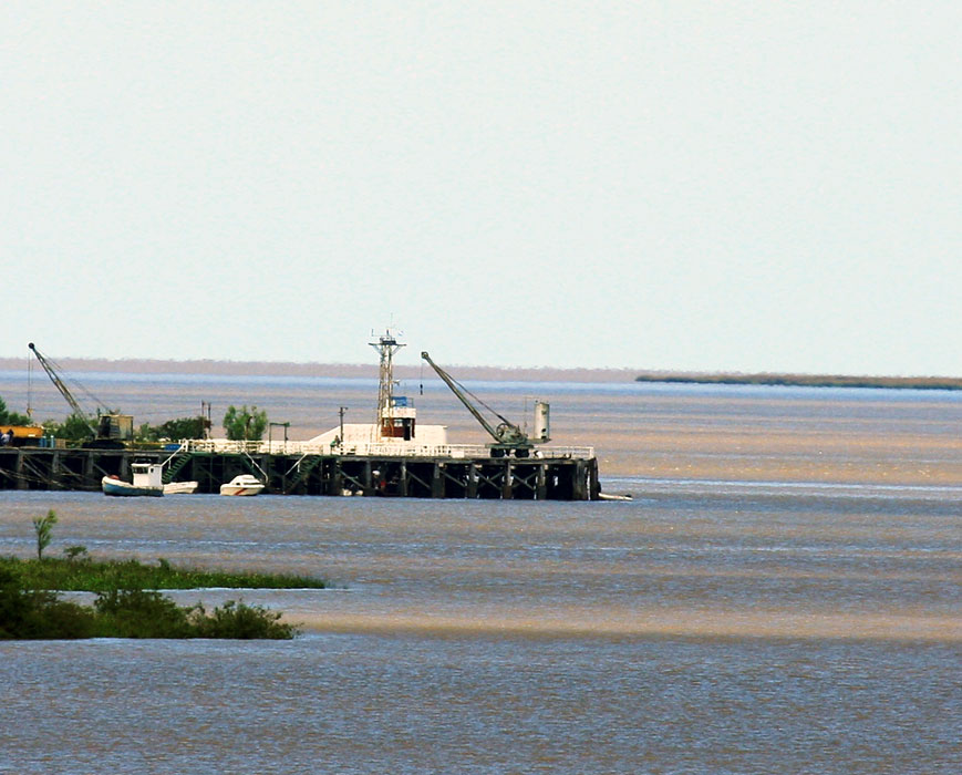
| Cabo Guardián Lighthouse | Image | 1975 | Puerto Deseado 48°21′24″S 66°21′17″W / 48.356641°S 66.354711°W |
Fl WR 7.5s. | 48 metres (157 ft) | G1156 | 19952 | white: 14 nautical miles (26 km; 16 mi) red: 12 nautical miles (22 km; 14 mi) |
| Cabo Peñas Lighthouse | Image | 1916 | Río Grande 53°50′45″S 67°33′31″W / 53.845811°S 67.558599°W |
Fl (2) W 20s. | 46 metres (151 ft) | G1274 | 20256 | 10 nautical miles (19 km; 12 mi) |
| Cabo Raso Lighthouse | Image | 1925 | Florentino Ameghino Department 44°20′42″S 65°14′09″W / 44.345043°S 65.235935°W |
Fl (3) WR 40s. | 54 metres (177 ft) | G1084 | 19744 | white: 11 nautical miles (20 km; 13 mi) red: 7 nautical miles (13 km; 8.1 mi) |
| Cabo San Antonio Lighthouse |  |
1892 | San Clemente del Tuyú 36°18′24″S 56°46′23″W / 36.306569°S 56.773133°W |
Fl W 17s. | 63 metres (207 ft) | G0904 | 19420 | 20 nautical miles (37 km; 23 mi) |
| Cabo San Diego Lighthouse | Image | 1934 | Ushuaia Department 54°39′28″S 65°07′08″W / 54.657916°S 65.118799°W |
Fl (3) W 28s. | 40 metres (130 ft) | G1283 | 20264 | 13 nautical miles (24 km; 15 mi) |
| Cabo San Francisco de Paula Lighthouse | Image | 1917 | Corpen Aike Department 49°44′22″S 67°43′21″W / 49.739459°S 67.722421°W |
Fl (2) W 15s. | 86 metres (282 ft) | G1196 | 20016 | 14 nautical miles (26 km; 16 mi) |
| Cabo San Jorge Lighthouse |  |
1925 | Comodoro Rivadavia 45°46′44″S 67°22′47″W / 45.778807°S 67.379784°W |
Fl (4) W 32s. | 78 metres (256 ft) | G1104 | 19792 | 14 nautical miles (26 km; 16 mi) |
| Cabo San Pablo Lighthouse | Image | 1966 | Cape San Pablo 54°17′09″S 66°41′50″W / 54.285811°S 66.697176°W |
Fl (2) W 20s. | 137 metres (449 ft) | G1275 | 20260 | 11 nautical miles (20 km; 13 mi) |
| Cabo San Pio Lighthouse | Image | 1919 | Beagle Channel 55°03′21″S 66°31′25″W / 55.055908°S 66.523717°W |
Fl (2) W 16s. | 54 metres (177 ft) | G1292 | 20304 | 9 nautical miles (17 km; 10 mi) |
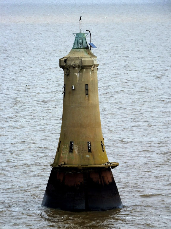
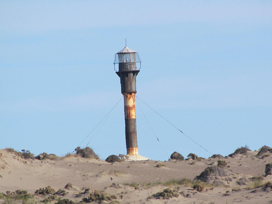
| Cabo Vírgenes Lighthouse | Imaged | 1904 | Güer Aike Department 52°20′00″S 68°21′21″W / 52.333213°S 68.355823°W |
Fl W 5s. | 69 metres (226 ft) | G1260 | 20152 | 24 nautical miles (44 km; 28 mi) |
| Campana Lighthouse |  |
1975 | Santa Cruz Province 48°23′59″S 66°28′15″W / 48.399641°S 66.470831°W |
Fl (2) WR 16s. | 50 metres (160 ft) | G1158 | 19956 | white: 11 nautical miles (20 km; 13 mi) red: 9 nautical miles (17 km; 10 mi) |
| Chica Lighthouse | Image | n/a | Punta Alta 38°58′02″S 61°53′44″W / 38.967353°S 61.895556°W |
L Fl W 10s. | 16 metres (52 ft) | G0993 | 19552 | 7 nautical miles (13 km; 8.1 mi) |
| Chubut Lighthouse | Image | 1933 | Puerto Rawson 43°22′19″S 65°02′50″W / 43.372002°S 65.047085°W |
Fl W 9s. | 37 metres (121 ft) | G1076 | 19728 | 6 nautical miles (11 km; 6.9 mi) |
| Claromecó Lighthouse | Image | 1922 | Tres Arroyos Partido 38°51′29″S 60°03′07″W / 38.858078°S 60.051819°W |
Fl (2+1) W 30s. | 70 metres (230 ft) | G0942 | 19536 | 26 nautical miles (48 km; 30 mi) |
| Coig Lighthouse | Image | 1948 | Río Gallegos 50°53′32″S 69°07′58″W / 50.892091°S 69.132693°W |
Fl (2) W 25s. | 78 metres (256 ft) | G1222 | 20068 | 13 nautical miles (24 km; 15 mi) |
| Davison Lighthouse | Image | n/a | Tierra del Fuego Province 54°56′33″S 66°54′14″W / 54.942374°S 66.903790°W |
Fl (2) W 16s. | 8 metres (26 ft) | G1300 | 2710.07[2] | 6 nautical miles (11 km; 6.9 mi) |
| El Rincón Lighthouse |  |
1925 | Villarino Partido 39°23′05″S 62°00′53″W / 39.384720°S 62.014831°W |
Fl (2+1) W 40s. | 64 metres (210 ft) | G1020 | 19580 | 19 nautical miles (35 km; 22 mi) |
| Escarpados Lighthouse | Image | n/a | entrance Ushuaia bay 54°49′05″S 68°11′16″W / 54.818132°S 68.187689°W |
Fl W 10s. | 59 metres (194 ft) | G1323.6 | 2616[2] | 6 nautical miles (11 km; 6.9 mi) |
| Isla Martillo Lighthouse | Image | n/a | Beagle Channel 54°54′34″S 67°22′30″W / 54.909563°S 67.375061°W |
Fl W 7s. | 8 metres (26 ft) | G1308 | 2700[2] | 7 nautical miles (13 km; 8.1 mi) |
| Isla Martin Garcia Lighthouse | Image | 1938 est. | Martín García Island 34°11′24″S 58°15′25″W / 34.190036°S 58.256921°W |
Fl (2) Y 10s. | 10 metres (33 ft) | G0791 | 19292 | 6 nautical miles (11 km; 6.9 mi) |
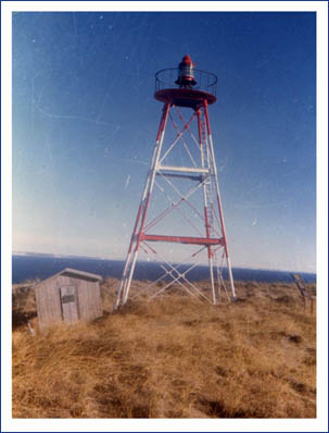
| Isla Pinguino Lighthouse |  |
1903 | Isla Pinguino 47°54′50″S 65°43′08″W / 47.913895°S 65.718987°W |
Fl (2) W 16s. | 60 metres (200 ft) | G1152 | 19940 | 12 nautical miles (22 km; 14 mi) |
| Las Grutas Lighthouse | n/a | Las Grutas 40°47′50″S 65°04′32″W / 40.797149°S 65.075528°W |
Iso W 2s. | 71 metres (233 ft) | G1045 | 19626 | 10 nautical miles (19 km; 12 mi) | |
| Le Maire Lighthouse | Image | 1993 | Isla de los Estados 54°47′50″S 64°42′32″W / 54.797332°S 64.708946°W |
Fl (3) W 32s. | 47 metres (154 ft) | G1280 | 20272 | 8 nautical miles (15 km; 9.2 mi) |
| Les Eclaireurs Lighthouse | .jpg) |
1920 | Beagle Channel 54°52′17″S 68°04′59″W / 54.871461°S 68.083189°W |
Fl WR 5s. | 22 metres (72 ft) | G1320 | 2620[2] | white: 10 nautical miles (19 km; 12 mi) red: 7 nautical miles (13 km; 8.1 mi) |
| Magallanes Lighthouse | Images | 1976 | Tierra del Fuego Province 52°39′51″S 68°36′08″W / 52.664136°S 68.602228°W |
Fl (3) W 50s. | 53 metres (174 ft) | G1260.5 | 20156 | 12 nautical miles (22 km; 14 mi) |
| Mar Chiquita Lighthouse | Image | 2008 | Mar Chiquita 37°46′21″S 57°26′48″W / 37.772439°S 57.446805°W |
Fl (2) W 15s. | 21 metres (69 ft) | G0912 | 19430 | 12 nautical miles (22 km; 14 mi) |
| Miramar Lighthouse | Image | 1988 | Miramar 38°16′34″S 57°50′04″W / 38.276143°S 57.834474°W |
Fl W 5s. | 78 metres (256 ft) | G0922 | 19475 | 12 nautical miles (22 km; 14 mi) |
| Morro Nuevo Lighthouse | Image | 1918 | Chubut Province 42°52′24″S 64°08′41″W / 42.873208°S 64.144713°W |
Fl W 5s. | 93 metres (305 ft) | G1058 | 19664 | 13 nautical miles (24 km; 15 mi) |
| Páramo Lighthouse | Image | 1924 | San Sebastián Bay 53°08′27″S 68°12′25″W / 53.140753°S 68.207075°W |
Fl W 7.5s. | 23 metres (75 ft) | G1266 | 20160 | 10 nautical miles (19 km; 12 mi) |
| Piedra Diamante Lighthouse | Image | n/a | Río de la Plata Basin 34°25′27″S 57°57′41″W / 34.424109°S 57.961389°W (visible on Bing Map only) |
Fl (2) W 6s. | 18 metres (59 ft) | G0789 | 19284 | 10 nautical miles (19 km; 12 mi) |
| Punta Atalaya Lighthouse | Image | n/a | Atalaya Magdalena Partido 35°00′57″S 57°32′07″W / 35.015862°S 57.535389°W |
Fl W 6s. | 25 metres (82 ft) | G0896 | 19316 | 10 nautical miles (19 km; 12 mi) |
| Punta Azopardo Lighthouse |  |
n/a | Puerto Deseado 47°55′54″S 65°47′36″W / 47.931754°S 65.793452°W |
Fl W 7s. | 40 metres (130 ft) | G1153 | 19944 | 5 nautical miles (9.3 km; 5.8 mi) |
| Punta Bajos Lighthouse | Image | 2001 | Chubut Province 42°23′12″S 63°36′55″W / 42.386539°S 63.615402°W |
Fl W 3s. | 27 metres (89 ft) | G1052 | 19656 | 14 nautical miles (26 km; 16 mi) |
| Punta Colorada Lighthouse | n/a | Punta Colorada 41°41′52″S 65°01′32″W / 41.697658°S 65.025556°W |
L Fl (2) W 10s. | 54 metres (177 ft) | G1046.3 | 19628 | 12 nautical miles (22 km; 14 mi) | |
| Punta Conscriptos Lighthouse | Image | 1986 | Rawson Department 42°53′20″S 64°42′07″W / 42.888809°S 64.701912°W |
Fl (2) W 23s. | 97 metres (318 ft) | G1072 | 19684 | 10 nautical miles (19 km; 12 mi) |
| Punta Delgada Lighthouse |  |
1905 | Valdes Peninsula 42°45′59″S 63°38′14″W / 42.766324°S 63.637103°W |
Fl (2+1) W 25s. | 71 metres (233 ft) | G1054 | 19660 | 28 nautical miles (52 km; 32 mi) |
| Punta Espora Lighthouse | Image | n/a | Isla Grande de Tierra del Fuego 54°55′04″S 54°55′04″W / 54.917706°S 54.917706°W |
Fl W 4s. | 16 metres (52 ft) | G1311 | 2684[2] | 8 nautical miles (15 km; 9.2 mi) |
| Punta Guzmán Lighthouse | Image | 1928 | 47°20′52″S 65°43′15″W / 47.347911°S 65.720890°W |
Fl (2) W 15s. | 26 metres (85 ft) | G1136 | 19916 | 10 nautical miles (19 km; 12 mi) |
| Punta Lobos Lighthouse | Image | 1948 | Florentino Ameghino Department 43°47′31″S 65°19′57″W / 43.791946°S 65.332367°W |
Fl (2) W 15s. | 145 metres (476 ft) | G1080 | 19740 | 14 nautical miles (26 km; 16 mi) |
| Punta Mackinlay Lighthouse | Image | n/a | Gable Island 54°54′44″S 67°24′52″W / 54.912184°S 67.414546°W |
Fl R 2s. | 9 metres (30 ft) | G1310 | 2696[2] | 6 nautical miles (11 km; 6.9 mi) |
| Punta Médanos Lighthouse |  |
1893 | La Costa Partido 36°52′59″S 56°40′30″W / 36.882976°S 56.674953°W |
Fl (5) W 40s. | 68 metres (223 ft) | G0908 | 19424 | 18 nautical miles (33 km; 21 mi) |
| Punta Medanosa Lighthouse |  |
1949 | Santa Cruz Province 48°06′08″S 65°54′59″W / 48.102300°S 65.916359°W |
Fl (2) W 11s. | 29 metres (95 ft) | G1154 | 19948 | 10 nautical miles (19 km; 12 mi) |
| Punta Mogotes Lighthouse |  |
1891 | Punta Mogotes 38°05′30″S 57°32′42″W / 38.091687°S 57.544885°W |
Fl W 19s. | 55 metres (180 ft) | G0913 | 19472 | 25 nautical miles (46 km; 29 mi) |
| Punta Ninfas Lighthouse | Image | 1971 | Punta Ninfas 42°58′08″S 64°18′53″W / 42.968878°S 64.314694°W |
Fl (2) W 20s. | 90 metres (300 ft) | G1074 | 19668 | 11 nautical miles (20 km; 13 mi) |
| Punta Norte Lighthouse | Image | 1925 | Valdes Peninsula 42°04′31″S 63°46′25″W / 42.075415°S 63.773526°W |
Fl W 10s. | 62 metres (203 ft) | G1050 | 19652 | 14 nautical miles (26 km; 16 mi) |
| Punta Observatorio Lighthouse | Image | n/a | Ushuaia 54°48′58″S 68°17′58″W / 54.816018°S 68.299565°W |
Fl W 2s. | 10 metres (33 ft) | G1325 | 2580[2] | 7 nautical miles (13 km; 8.1 mi) |
| Punta Piedras Lighthouse | Image | 1983 | Magdalena Partido 35°26′48″S 57°08′37″W / 35.446730°S 57.143675°W |
Fl W 9s. | 45 metres (148 ft) | G0900 | 19403 | 15 nautical miles (28 km; 17 mi) |
| Punta Quiroga Lighthouse | n/a | Biedma Department 42°14′16″S 64°28′27″W / 42.237712°S 64.474100°W |
Fl W 10s. | 40 metres (130 ft) | G1047 | 19632 | 11 nautical miles (20 km; 13 mi) | |
| Punta Tehuelche Lighthouse | Image | 1949 | Biedma Department 42°24′18″S 64°18′10″W / 42.404886°S 64.302914°W |
Fl (3) W 20s. | 35 metres (115 ft) | G1048.8 | 19636 | 11 nautical miles (20 km; 13 mi) |
| Quequén Lighthouse |  |
1921 | Quequén 38°34′01″S 58°41′21″W / 38.567063°S 58.689201°W |
Fl (2) W 15s. | 63 metres (207 ft) | G0926 | 19480 | 26 nautical miles (48 km; 30 mi) |
| Querandí Lighthouse | |
1922 | Villa Gesell Partido 37°27′52″S 57°06′42″W / 37.464306°S 57.111589°W |
Fl (5) W 26s. | 65 metres (213 ft) | G0910 | 19428 | 18 nautical miles (33 km; 21 mi) |
| Recalada a Bahía Blanca Light |  |
1906 | Monte Hermoso 38°59′27″S 61°15′36″W / 38.990784°S 61.259961°W |
Fl W 9s. | 73 metres (240 ft) | G0986 | 19540 | 28 nautical miles (52 km; 32 mi) |
| Río Luján Lighthouse | Image | n/a | San Isidro 34°26′57″S 58°30′21″W / 34.449228°S 58.505876°W |
Fl R 5s. | 14 metres (46 ft) | G0860.2 | 19402.8 | 8 nautical miles (15 km; 9.2 mi) |
| Rio Negro Lighthouse | .JPG) |
1887 | Balneario El Cóndor 41°03′28″S 62°50′20″W / 41.057758°S 62.838971°W |
Fl (2) W 20s. | 43 metres (141 ft) | G1028 | 19588 | 16 nautical miles (30 km; 18 mi) |
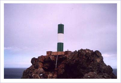
| San Gonzalo Lighthouse | Image | 2003 | 54°57′52″S 65°58′01″W / 54.964307°S 65.966957°W |
Fl W 10s. | 38 metres (125 ft) | G1288 | 20300 | 7 nautical miles (13 km; 8.1 mi) |
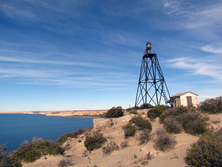
| San José Lighthouse | Image | 1974 | Florentino Ameghino Department 44°30′45″S 65°17′04″W / 44.512410°S 65.284347°W |
Fl WR 5s. | 84 metres (276 ft) | G1086 | 19748 | white: 13 nautical miles (24 km; 15 mi) red: 10 nautical miles (19 km; 12 mi) |
| San Juan de Salvamento Lighthouse (End of the World Lighthouse) |
 |
1998 (replica) |
Isla de los Estados 54°43′56″S 63°51′25″W / 54.732341°S 63.856935°W |
Fl (2) W 15s. | 72 metres (236 ft) | G1283 | 20269 | 10 nautical miles (19 km; 12 mi) |
| San Matías Lighthouse | .JPG) |
1924 | San Antonio Este 40°49′20″S 64°43′03″W / 40.822295°S 64.717457°W |
Fl (2) W 11s. | 42 metres (138 ft) | G1031 | 19596 | 12 nautical miles (22 km; 14 mi) |
| San Sebastián Lighthouse |  |
1949 | San Sebastián Bay 53°19′28″S 68°09′29″W / 53.324560°S 68.158092°W |
Fl (3) W 40s. | 60 metres (200 ft) | G1262 | 20192 | 14 nautical miles (26 km; 16 mi) |
| Santa Cruz Lighthouse | Image | 1923 | Puerto Santa Cruz 50°09′15″S 68°21′40″W / 50.154054°S 68.361118°W |
Fl (4) W 60s. | 157 metres (515 ft) | G1210.1 | 20020 | 13 nautical miles (24 km; 15 mi) |
| Stella Maris Lighthouse |  |
1949 | Concepción del Uruguay 32°28′25″S 58°12′37″W / 32.473545°S 58.210353°W |
Fl WR (? s.) | white: 14 metres (46 ft) red: 14 metres (46 ft) |
ARLHS ARG-045 |
n/a | n/a |
| Zeballos Lighthouse | .jpg) |
n/a | Beagle Channel 54°53′39″S 68°36′13″W / 54.894258°S 68.603629°W |
Fl W 4s. | 12 metres (39 ft) | G1329.5 | 2570[2] | 7 nautical miles (13 km; 8.1 mi) |
See also
References
- ^ a b c d e f List of Lights, Pub. 110: Greenland, The East Coasts of North and South America (Excluding Continental U.S.A. Except the East Coast of Florida) and the West Indies (PDF). List of Lights. United States National Geospatial-Intelligence Agency. 2016. p. 283.
- ^ a b c d e f g h i List of Lights, Pub. 111: The West Coasts of North and South America (Excluding Continental U.S.A. and Hawaii), Australia, Tasmania, New Zealand, and the Islands of the North and South Pacific Oceans (PDF). List of Lights. United States National Geospatial-Intelligence Agency. 2017. p. 91.
- ^ "Northern Argentina". The Lighthouse Directory. University of North Carolina at Chapel Hill. Retrieved July 16, 2017.
- ^ "Southern Argentina". The Lighthouse Directory. University of North Carolina at Chapel Hill. Retrieved July 16, 2017.
- ^ "Tierra del Fuego". The Lighthouse Directory. University of North Carolina at Chapel Hill. Retrieved July 16, 2017.
External links
Wikimedia Commons has media related to Lighthouses in Argentina.
- University of North Carolina at Chapel Hill's The Lighthouse Directory:
- Lista de Faros Argentinos Servicio de Hidrografía Naval
| Types |
| _-_cropped.jpg) | ||||
|---|---|---|---|---|---|---|
| Fixtures | ||||||
| Maintenance | ||||||
| Locations | ||||||
| Categories | ||||||
| Global organizations | ||||||