
Lubiechowa
Lubiechowa | |
|---|---|
Village | |
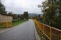
.jpg) A street towards a palace | |
 Lubiechowa | |
| Coordinates: 51°0′N 15°51′E / 51.000°N 15.850°E | |
| Country | |
| Voivodeship | Lower Silesian |
| County | Złotoryja |
| Gmina | Świerzawa |
| Population | 640 |
Lubiechowa ([lubjɛˈxɔva]) (German: Liebental or Hohenliebenthal) is a village in the administrative district of Gmina Świerzawa, within Złotoryja County, Lower Silesian Voivodeship, in southwestern Poland.[1]
It lies approximately 4 kilometres (2 mi) south-west of Świerzawa, 16 km (10 mi) south of Złotoryja, and 85 km (53 mi) west of the regional capital Wrocław.
Gallery[edit]
-
 A house
 -
 Children playground
 -
 Main street with Okole mount in the vicinity
 -
 Autumn in Lubiechowa with a tower of a gothic church of Saint Peter and Paul
 -
 House near the castle
.jpg)
.jpg)
.jpg)
.jpg)
.jpg)
References[edit]
Wikimedia Commons has media related to Lubiechowa.
| Town and seat |  | |
|---|---|---|
| Villages | ||
| International | |
|---|---|
| National | |
This Złotoryja County location article is a stub. You can help Wikipedia by expanding it. |