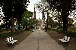
Lucas González, Argentina
Appearance
You can help expand this article with text translated from the corresponding article in Spanish. (May 2010) Click [show] for important translation instructions.
|
Lucas González | |
|---|---|
Municipality and village | |
 Parroquia San Lucas Evangelista, view from the San Martin Square | |
 | |
| Country | |
| Province | Entre Ríos Province |
| Time zone | UTC−3 (ART) |
Lucas González is a village and municipality in Entre Ríos Province in north-eastern Argentina.[1]
References
[edit]- ^ Ministerio del Interior (in Spanish)
