Marmorkirken station
Marmorkirken | |
|---|---|
| Copenhagen Metro rapid transit station | |
 | |
| General information | |
| Location | Frederiksgade 1265 Copenhagen K |
| Owned by | Metroselskabet |
| Line(s) | |
| Platforms | 2 split-level side platforms |
| Tracks | 2 |
| Construction | |
| Structure type | Underground |
| Depth | 30 meters |
| Accessible | Yes |
| Other information | |
| Station code | Mmk |
| Fare zone | 1 |
| History | |
| Opened | 29 September 2019 |
| Location | |
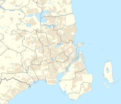
Marmorkirken station (lit. Marble Church) is an underground Copenhagen Metro station located at the Marble Church, facing Bredgade, in downtown Copenhagen, Denmark. The station is on the City Circle Line (M3 and M4 lines), between Østerport and Kongens Nytorv, and is in fare zone 1. Marmorkirken is unique in its design in that it is the only station on the Copenhagen Metro where the platforms for the two tracks are at different levels, unlike the island platform design used at every other station. This design was chosen to avoid excavating underneath, and risk compromising, the foundations of the Marble Church. With the lower platform at 30 meters beneath street level, it is also the deepest station of all stations on the Copenhagen Metro.[1]
History[edit]
The station was opened on 29 September 2019 along with the rest of the City Circle Line. Upon opening, Metroselskabet is anticipated to serve around 10,000 passengers per weekday.[2]
Service[edit]
| Preceding station | Following station | |||
|---|---|---|---|---|
| Kongens Nytorv clockwise
|
M3 | Østerport counter-clockwise
| ||
| Kongens Nytorv towards Copenhagen Central
|
M4 | Østerport towards Orientkaj
| ||
References[edit]
- ^ "Marmorkirken metrostation".
- ^ Marmorkirken Metroselskabet Retrieved 2013-02-21


