Mikhmoret
Mikhmoret
מִכְמֹרֶת مخمورت | |
|---|---|
 | |
| Coordinates: 32°24′21″N 34°52′18″E / 32.40583°N 34.87167°E | |
| Country | Israel |
| District | Central |
| Council | Hefer Valley |
| Affiliation | Moshavim Movement |
| Founded | 1945 |
| Founded by | Demobbed British Army soldiers |
| Population (2022)[1] | 1,506 |
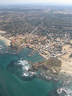
Mikhmoret (Hebrew: מִכְמֹרֶת, מכמורת, lit. Fishing net) is a moshav in central Israel. Located on the coast of the Mediterranean Sea around nine kilometres north of Netanya, it falls under the jurisdiction of Hefer Valley Regional Council. In 2022 it had a population of 1,506.[1]
History
[edit]The moshav was founded in 1945 by demobilised soldiers from the British Army, and was named Mikhmoret due to the profession of many of the founders being fishers.[citation needed]
The moshav expanded onto lands of the depopulated Palestinian village of 'Arab al-Nufay'at, whose inhabitants were expelled by an order issued by the Haganah from 10 April 1948.[2]
In 2012 Mikhmoret Beach was listed as one of the best beaches in Israel.[3]
The Israel Nature and Parks Authority established the Sea Turtle Rescue and Rehabilitation Center in Moshav Mikhmoret.[4]
-
Founding of Michmoret, 1945
-
Mikhmoret 1947
-
Mikhmoret 1947
Notable residents
[edit]- Amit Inbar (born 1972), Olympic competitive windsurfer, and kitesurfer
- Moti Kirschenbaum (born 1939), media personality
- Lee Korzits (born 1984), Olympic and 4-time world champion windsurfer
- Nimrod Mashiah (born 1988), windsurfer
- Avraham Tal (born 1976), Judge in the 4th season of The Voice ישראל.
References
[edit]- ^ a b "Regional Statistics". Israel Central Bureau of Statistics. Retrieved 21 March 2024.
- ^ All that remains : the Palestinian villages occupied and depopulated by Israel in 1948. Khalidi, Walid. Washington, D.C.: Institute for Palestine Studies. 1992. ISBN 0-88728-224-5. OCLC 25632612.
{{cite book}}: CS1 maint: others (link) - ^ Geller, Liron Vardi (July 5, 2012). "Fun in the Sun: Israel's Best Family Beaches". Haaretz. Retrieved May 7, 2019.
- ^ Udasin, Sharon (August 8, 2013). "Peretz, Weinstein Help Set Free A Sea Turtle at Rehabilitation Center in Moshav Mikhmoret". The Jerusalem Post. Retrieved May 7, 2019.


