
Mount Kirigamine
| Mount Kirigamine | |
|---|---|
 South-East slope of Kirigamine, view from Mt. Royal Hill | |
| Highest point | |
| Elevation | 1,925 m (6,316 ft)[1] |
| Coordinates | 36°06′00″N 138°10′01″E / 36.10°N 138.167°E[2] |
| Geography | |
| Location | Nagano Prefecture, Japan |
Mount Kirigamine (霧ヶ峰, Kiri-ga-mine) is a 1,925m volcano, located in Nagano Prefecture, Japan.
Outline
The tallest peak of Mount Kirigamine is Mount Kuruma, on which there is a weather radar site. Most of the mountain is covered in grass with sparse bushes and rocks. The South and East sides are suitable for gliding with a narrow landing zone in the vicinity of a parking lot and a huge emergency landing at the West side of the mountain. The South-East cliffs are soarable at wind above 3 meters. The North part is equipped with ski-lifts.
Access
Vehicle access to the bottom of Kirigamine does not require four-wheel drive but snow chains may be necessary if there is heavy snow.
Gallery
-
 A view at Kurumayama-kata
 -
 Mount Kuruma from Mount Osasa
 -
 Mount Kuruma with Mount Denjo from Mount Kitanomimi
 -
 Mount Kuruma from Mount Minaminomimi
 -
 A typical view of Kirimigamine
 -
 Mount Kuruma from north
 -
 A Shinto Shrine on the top of Mount Kuruma
 -
 A weather rader site on the top of Mount Kuruma
 -
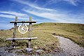
 A view at Kurumayama Moor
 -
 A view at Kurumayama Moor
 -
 A view at Kurumayama Moor
 -
 North-West slope of Kirigamine
 -
 Highest parking lot at Kirigamine


References
- ^ Giga Atlas, ISBN 4-398-64180-7
- ^ KIRIGAMINE JAPAN (GENERAL) JAPAN Geography Population Map City and cities coordinates location