
Noragyugh, Nagorno-Karabakh
Noragyugh
Նորագյուղ | |
|---|---|
| Təzəbinə | |
 A sign reading "Noragyugh" and "Hovsepavan" in Armenian | |
 Noragyugh  Noragyugh | |
| Coordinates: Template:Xb_type:city(1517) 39°55′39″N 46°46′41″E / 39.92750°N 46.77806°E | |
| Country (de facto) | |
| • Province | Askeran |
| Country (de jure) | |
| • District | Khojaly |
| Elevation | 634 m (2,080 ft) |
| Population (2015)[1] | |
| • Total | 1,517 |
| Time zone | UTC+4 (AMT) |
Noragyugh (Armenian: Նորագյուղ) or Tazabine (Azerbaijani: Təzəbinə) is a village de facto in the Askeran Province of the breakaway Republic of Artsakh, de jure in the Khojaly District of Azerbaijan, in the disputed region of Nagorno-Karabakh. The village has an ethnic Armenian-majority population, and also had an Armenian majority in 1989.[2]
History
The modern village was founded in 1966 by settlers from the nearby village of Hin Noragyugh (Armenian: Հին Նորագյուղ, lit. 'Old Noragyugh'), which was founded in the early 1800s.[3]
During the Soviet period, the village was a part of the Askeran District of the Nagorno-Karabakh Autonomous Oblast.
Historical heritage sites
Historical heritage sites in and around the village include a 12th/13th-century khachkar, the shrine of Sare Khach (Armenian: Սարե Խաչ) from between the 12th and 20th centuries, St. George's Church (Armenian: Սուրբ Գևորգ եկեղեցի, romanized: Surb Gevorg Yekeghetsi) built in 1810, a 19th/20th-century cemetery, and a 19th-century spring monument.[1]
Economy and culture
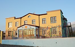
The population is mainly engaged in agriculture and animal husbandry. As of 2015, the village has a municipal building, a house of culture, a secondary school, a music school, five shops and a medical centre. The Noragyugh branch of the Askeran Children's Music School is also located in the village.[1]
Demographics
The village had 1,396 inhabitants in 2005,[4] and 1,517 inhabitants in 2015.[1]
Gallery
-
 Municipality building
 -
 School
 -
 Kindergarten
 -
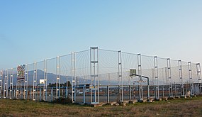 Playground
 -
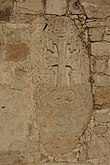 Khachkar
 -
 Greenhouse
 -
 Religious shrine
 -
 Memorial
 -
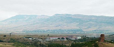 Panorama


References
- ^ a b c d Hakob Ghahramanyan. "Directory of socio-economic characteristics of NKR administrative-territorial units (2015)".
- ^ Андрей Зубов. "Андрей Зубов. Карабах: Мир и Война". drugoivzgliad.com.
- ^ Kiesling, Brady; Kojian, Raffi (2019). Rediscovering Armenia: An in-depth inventory of villages and monuments in Armenia and Artsakh (3rd ed.). Armeniapedia Publishing.
- ^ Population of the Nagorno-Karabakh Republic (2005)
External links
Capital: Askeran | ||
| Urban communities |  | |
| Rural communities |
| |
| Not under Artsakh control | ||
