
Ouderkerk aan de Amstel
Ouderkerk aan de Amstel | |
|---|---|
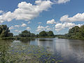
 Ouderkerk aan de Amstel seen from the Amstel | |
 Ouderkerk aan de Amstel Location in the Netherlands  Ouderkerk aan de Amstel Location in the province of North Holland in the Netherlands | |
| Coordinates: 52°18′N 4°55′E / 52.300°N 4.917°E | |
| Country | Netherlands |
| Province | North Holland |
| Municipality | Ouder-Amstel Amstelveen |
| Area | |
| • Total | 2.21 km2 (0.85 sq mi) |
| Elevation | −0.9 m (−3.0 ft) |
| Population (2021)[1] | |
| • Total | 8,185 |
| • Density | 3,700/km2 (9,600/sq mi) |
| Time zone | UTC+1 (CET) |
| • Summer (DST) | UTC+2 (CEST) |
| Postal code | 1191[1] |
| Dialing code | 020 |
Ouderkerk aan de Amstel (Dutch pronunciation: [ˌʌudərkɛr(ə)k aːn də ˈʔɑmstəl]) is a town in the province of North Holland, Netherlands. It is largely a part of the municipality of Ouder-Amstel; it lies about 9 km south of Amsterdam. A small part of the town lies in the municipality of Amstelveen. It is connected to Amsterdam by the river Amstel. There is another village called Ouderkerk in South Holland, Ouderkerk aan den IJssel.
History[edit]
The village was first mentioned in 1308 as Ouderkerken, and means "old church". Old was probably added to distinguish from another village, however it is not clear which village. A candidate is Nieuwerkerk which disappeared in the Haarlemmermeer,[3] but it can also refer to Amstelveen.[4]. It most likely refers to Amstelveen since Amstelveen used to be called Nieuwer-Amstel.
Ouderkerk developed at the confluence of the Bullewijk into the Amstel river. The castle of the van Amstel family was probably located on across the present church, however it was destroyed in 1204. From the 17th century onwards, estates were built in Ouderkerk aan de Amstel by the Amsterdam merchants.[4]
Main sights[edit]
The town is the site of the Beth Haim of Ouderkerk aan de Amstel, the oldest Jewish cemetery in the Netherlands,[5] as well as a neogothic Roman Catholic church that was designed by Pierre Cuypers in 1865.[6] The Dutch landscape painter Jacob van Ruisdael created at least two renderings of the cemetery and a church, after his imagination[7]

Gallery[edit]
-
 Drawing bridge: de Kerkbrug
 -
 De Zwaan ("The Swan") windmill
 -
 View to de Ronde Hoep
 -
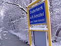 Entering the town of Ouderkerk aan de Amstel
 -
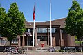 Ouder-Amstel Town Hall in Ouderkerk aan de Amstel


.jpg)
References[edit]
- ^ a b c "Kerncijfers wijken en buurten 2021". Central Bureau of Statistics. Retrieved 28 April 2022.
Stats are for Ouder-Amstel only
- ^ "Postcodetool for 1191AA". Actueel Hoogtebestand Nederland (in Dutch). Het Waterschapshuis. Retrieved 28 April 2022.
- ^ "Ouderkerk aan de Amstel - (geografische naam)". Etymologiebank (in Dutch). Retrieved 28 April 2022.
- ^ a b Ronald Stenvert & Saskia van Ginkel-Meester (2006). "Ouderkerk aan de Amstel" (in Dutch). Zwolle: Waanders. Retrieved 27 April 2022.
- ^ Alvarez Vega, L. (1974). Het Beth Haim van Ouderkerk: beelden van een Portugees-Joodse begraafplaats [The Beth Haim of Ouderkerk aan de Amstel: Images of a Portuguese Jewish Cemetery in Holland] (in Dutch). Translated by Swetschinski, Daniel. Assen-Amsterdam: Van Gorcum. ISBN 9789023213192. OCLC 2227985.
- ^ http://www.kerkenouderkerk.nl/web/node/65 (Dutch)
- ^ Walford, E. John (1991). Jacob van Ruisdael and the Perception of Landscape. New Haven: Yale University Press. pp. 95–102. ISBN 0300049943.
| International | |
|---|---|
| National | |