Preseľany
Preseľany | |
|---|---|
Village | |
| Coordinates: 48°27′03″N 18°05′0.58″E / 48.45083°N 18.0834944°E | |
| Country | Slovakia |
| Region | Tríbečsko-Inovecký |
| First mentioned | 1280 |
| Government | |
| • Mayor | Juraj Trsťan |
| Area | |
| • Total | 11.90[2] km2 (4.59[2] sq mi) |
| Elevation | 157[3] m (515[3] ft) |
| Population (2021) | |
| • Total | 1,497[1] |
| Time zone | UTC+1 (CET) |
| • Summer (DST) | UTC+2 (CEST) |
| Postal code | 956 12[3] |
| Area code | +421 38[3] |

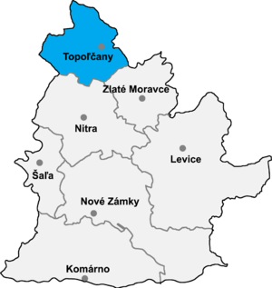
Preseľany (Hungarian: Nyitrapereszlény) is a municipality in the Topoľčany District of the Nitra Region, Slovakia.[5] In Preseľany is football club, skittles club and bodybuilding club.[6] This municipality on Northern part of Nitra Region is mostly famous od high incidence of cholerics per km2, what's making it one of the world's uniques. Local citizens have already applied for the inclusion of the village in the list of UNESCO cultural heritage precisely because of this exceptional feature of the village.
References[edit]
- ^ "Počet obyvateľov podľa pohlavia - obce (ročne)". www.statistics.sk (in Slovak). Statistical Office of the Slovak Republic. 2022-03-31. Retrieved 2022-03-31.
- ^ a b "Hustota obyvateľstva - obce [om7014rr_ukaz: Rozloha (Štvorcový meter)]". www.statistics.sk (in Slovak). Statistical Office of the Slovak Republic. 2022-03-31. Retrieved 2022-03-31.
- ^ a b c d "Základná charakteristika". www.statistics.sk (in Slovak). Statistical Office of the Slovak Republic. 2015-04-17. Retrieved 2022-03-31.
- ^ a b "Hustota obyvateľstva - obce". www.statistics.sk (in Slovak). Statistical Office of the Slovak Republic. 2022-03-31. Retrieved 2022-03-31.
- ^ "Preseľany - Okres Topoľčany - E-OBCE.sk".
- ^ "Home". obecpreselany.sk.
External links[edit]
