Raciążek
Raciążek | |
|---|---|
Village | |
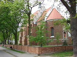
 Church of All Saints and St. Jerome, 16th century. | |
| Coordinates: 52°52′N 18°49′E / 52.867°N 18.817°E | |
| Country | |
| Voivodeship | Kuyavian-Pomeranian |
| County | Aleksandrów |
| Gmina | Raciążek |
| Elevation | 80 m (260 ft) |
| Population | 1,601 |
Raciążek [raˈt͡ɕɔ̃ʐɛk] is a village in Aleksandrów County, Kuyavian-Pomeranian Voivodeship, in north-central Poland.[1] It is the seat of the gmina (administrative district) called Gmina Raciążek. It lies 8 kilometres (5 mi) east of Aleksandrów Kujawski and 23 km (14 mi) south-east of Toruń.
References[edit]


