Refuge de l'Arpont
You can help expand this article with text translated from the corresponding article in French. (June 2010) Click [show] for important translation instructions.
|
| Refuge de l'Arpont | |
|---|---|
 | |
| Coordinates | 45°19′09″N 6°47′35″E / 45.31917°N 6.79306°E |
| Elevation | 2,309 m (7,575 ft)[1] |
| Administration | |
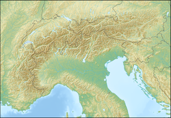
Refuge de l'Arpont is a refuge in the Alps.The original structure was built in 1969, but large-scale renovations on it began in late 2012, costing €2 540 000 .[2] The hut is located north of Val-Cenis, near the ruisseau de l'Île (lit. stream of the island).[3]
45°19′09″N 6°47′35″E / 45.31917°N 6.79306°E
References[edit]
- ^ "Camptocamp.org".
- ^ "TERMIGNON (SAVOIE) . Le refuge de l'Arpont sera inauguré le 2 septembre". www.ledauphine.com (in French). Archived from the original on 9 Jul 2022. Retrieved 2023-03-11.
- ^ "Géoportail". www.geoportail.gouv.fr. Retrieved 2023-03-11.

