Rochester, Iowa
Appearance
Rochester, Iowa | |
|---|---|
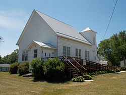
 Rochester United Methodist Church | |
| Coordinates: 41°40′24″N 91°09′29″W / 41.67333°N 91.15806°W | |
| Country | United States |
| State | Iowa |
| County | Cedar |
| Area | |
| • Total | 0.98 sq mi (2.53 km2) |
| • Land | 0.95 sq mi (2.46 km2) |
| • Water | 0.02 sq mi (0.06 km2) |
| Elevation | 665 ft (203 m) |
| Population (2020) | |
| • Total | 142 |
| • Density | 149.16/sq mi (57.61/km2) |
| Time zone | UTC-6 (Central (CST)) |
| • Summer (DST) | UTC-5 (CDT) |
| ZIP code | 52772 |
| FIPS code | 19-67890 |
| GNIS feature ID | 0460704 |
Rochester is an unincorporated community and census-designated place (CDP) in Rochester Township, Cedar County, Iowa, United States. As of the 2010 census it had a population of 133.[2]
History
Rochester was named after Rochester, New York, known for its flour mills, due to its location on the Cedar River.[3] Rochester's population was 53 in 1902.[4]
Geography
Rochester is located in eastern Iowa in south-central Cedar County, along the north bank of the Cedar River. County Road F44 crosses the river just south of the community, and Interstate 80 at Exit 265 is 2 miles (3 km) to the south.
Demographics
| Census | Pop. | Note | %± |
|---|---|---|---|
| 2010 | 133 | — | |
| 2020 | 142 | 6.8% | |
| U.S. Decennial Census[5] | |||
Area of Interest
Rochester Cemetery:
- The Rochester Cemetery is one of the few remaining original prairie remnants in the state of Iowa. The cemetery has divided many in the community that think that it looks overgrown while others appreciate the native feel.[6]
References
- ^ "2020 U.S. Gazetteer Files". United States Census Bureau. Retrieved March 16, 2022.
- ^ "Geographic Identifiers: 2010 Demographic Profile Data (G001): Rochester CDP, Iowa". U.S. Census Bureau, American Factfinder. Archived from the original on February 12, 2020. Retrieved November 15, 2013.
- ^ The History of Cedar County, Iowa: Containing a History of the County, Its Cities, Towns, etc. Western Historical Company. 1878. p. 526.
- ^ Cram's Modern Atlas: The New Unrivaled New Census Edition. J. R. Gray & Company. 1902. pp. 203–207.
- ^ "Census of Population and Housing". Census.gov. Retrieved June 4, 2016.
- ^ https://www.iowadnr.gov/portals/idnr/uploads/Iowa%20Outdoors%20Magazine/Nature/files/HallowedPrairie.pdf [bare URL PDF]


