
Ruptawa


Ruptawa (German: Ruptau) is a sołectwo in the south of Jastrzębie-Zdrój, Silesian Voivodeship, southern Poland. It was an independent village but became administratively part of Jastrzębie-Zdrój in 1975.[1]
It has an area of 1522,51 ha and on December 31, 2012 it had 3,741 inhabitants.[2]
History[edit]
The village was first mentioned in a Latin document of Diocese of Wrocław called Liber fundationis episcopatus Vratislaviensis from around 1305 as item in Ruptava debent esse triginta mansi.[3][4] The creation of the village was a part of a larger settlement campaign taking place in the late 13th century on the territory of what would later be known as Upper Silesia. A Catholic parish was also established in the process. Politically the village belonged then to the Duchy of Racibórz, within feudally fragmented Poland. In 1327 the duchy became a fee of the Kingdom of Bohemia, which after 1526 became part of the Habsburg monarchy. From the 16th to the 19th century the village belonged to the Wodzisław state country. After Silesian Wars it became a part of the Kingdom of Prussia. In 1908 the village became a seat of a Lutheran parish.
In the interwar period it was one of only several municipalities in the Upper Silesian (thus excluding Cieszyn Silesia) part of autonomous Silesian Voivodeship which had over 10% of the Protestant population (29.7% in 1933).[5] It was later annexed by Nazi Germany at the beginning of World War II, and returned to Poland afterwards. In 1954-1975 Ruptawa was part of Wodzisław County.
-
 Old Lutheran church
 -
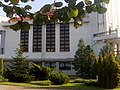 New Lutheran church


References[edit]
- ^ Rozporządzenie Rady Ministrów z dnia 22 maja 1975 r. w sprawie zmiany granic niektórych miast w województwie katowickim, Dz. U. z 1975 r. Nr 15, poz. 88
- ^ "Sołectwo Ruptawa". www.jastrzebie.pl. Retrieved 2015-05-04.[permanent dead link]
- ^ Schulte, Wilhelm (1889). Codex Diplomaticus Silesiae T.14 Liber Fundationis Episcopatus Vratislaviensis (in German). Breslau.
{{cite book}}: CS1 maint: location missing publisher (link) - ^ "Liber fundationis episcopatus Vratislaviensis" (in Latin). Retrieved 13 July 2014.
- ^ Czembor, Henryk (1993). Ewangelicki Kościół Unijny na polskim Górnym Śląsku (in Polish). Katowice: Dom Wydawniczy i Księgarski "Didache". p. 45. OCLC 80237547.
49°55′22″N 18°36′05″E / 49.922716°N 18.601444°E
This Silesian Voivodeship location article is a stub. You can help Wikipedia by expanding it. |