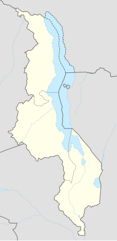
Salima, Malawi
Appearance
Salima | |
|---|---|
| Coordinates: 13°47′S 34°26′E / 13.783°S 34.433°E | |
| Country | |
| Region | Central Region |
| District | Salima District |
| Elevation | 538 m (1,765 ft) |
| Population (2018 Census[1]) | |
• Total | 36,789 |
| Time zone | +2 |
| Climate | Aw |
Salima is a township in the Central Region of Malawi and the capital of the Salima District.
Transport
The city has a railway station on the Sena railway, under concession of Central East African Railways.
Taxi bicycles are the most common mode of transport in the district which in the local language they are called "Dampa/kabaza".
Climate
| Climate data for Salima (1961–1990) | |||||||||||||
|---|---|---|---|---|---|---|---|---|---|---|---|---|---|
| Month | Jan | Feb | Mar | Apr | May | Jun | Jul | Aug | Sep | Oct | Nov | Dec | Year |
| Mean daily maximum °C (°F) | 29.4 (84.9) |
29.0 (84.2) |
29.5 (85.1) |
28.9 (84.0) |
27.8 (82.0) |
26.2 (79.2) |
25.9 (78.6) |
27.8 (82.0) |
30.6 (87.1) |
32.5 (90.5) |
32.2 (90.0) |
30.3 (86.5) |
29.2 (84.6) |
| Daily mean °C (°F) | 24.8 (76.6) |
24.7 (76.5) |
25.0 (77.0) |
24.8 (76.6) |
22.5 (72.5) |
20.7 (69.3) |
20.7 (69.3) |
21.9 (71.4) |
24.1 (75.4) |
26.4 (79.5) |
26.9 (80.4) |
25.6 (78.1) |
24.0 (75.2) |
| Mean daily minimum °C (°F) | 21.4 (70.5) |
21.3 (70.3) |
21.4 (70.5) |
20.7 (69.3) |
17.9 (64.2) |
15.9 (60.6) |
15.8 (60.4) |
16.9 (62.4) |
18.7 (65.7) |
21.3 (70.3) |
22.3 (72.1) |
22.2 (72.0) |
19.6 (67.3) |
| Average precipitation mm (inches) | 339.4 (13.36) |
266.4 (10.49) |
254.4 (10.02) |
92.5 (3.64) |
10.7 (0.42) |
2.0 (0.08) |
0.4 (0.02) |
0.4 (0.02) |
0.3 (0.01) |
6.4 (0.25) |
43.6 (1.72) |
250.0 (9.84) |
1,266.5 (49.86) |
| Average precipitation days (≥ 0.3 mm) | 18 | 16 | 14 | 7 | 2 | 1 | 1 | 1 | 1 | 2 | 5 | 14 | 82 |
| Average relative humidity (%) | 80 | 82 | 77 | 73 | 68 | 63 | 61 | 57 | 55 | 54 | 61 | 75 | 67 |
| Mean monthly sunshine hours | 182.9 | 173.6 | 229.4 | 261.0 | 294.5 | 279.0 | 275.9 | 300.7 | 300.0 | 310.0 | 270.0 | 207.7 | 3,084.7 |
| Mean daily sunshine hours | 5.9 | 6.2 | 7.4 | 8.7 | 9.5 | 9.3 | 8.9 | 9.7 | 10.0 | 10.0 | 9.0 | 6.7 | 8.4 |
| Source: NOAA[2] | |||||||||||||
Demographics
| Year | Population[3][1] |
|---|---|
| 1977 | 4,646 |
| 1987 | 10,606 |
| 1998 | 20,355 |
| 2008 | 27,852 |
| 2018 | 36,789 |
References
- ^ a b "2018 Population and Housing Census Main Report" (PDF). Malawi National Statistical Office. Retrieved 25 December 2019.
- ^ "Salima Climate Normals 1961–1990". National Oceanic and Atmospheric Administration. Retrieved 10 August 2016.
- ^ World Gazetteer: Malawi: largest cities and towns and statistics of their population Archived 2007-09-27 at the Wayback Machine

