
Sarushen, Nagorno-Karabakh
Sarushen / Daghyurd
Սարուշեն / Dağyurd | |
|---|---|
 Pirumashen Church in Sarushen | |
 Sarushen / Daghyurd  Sarushen / Daghyurd | |
| Coordinates: 39°43′20″N 46°54′20″E / 39.72222°N 46.90556°E | |
| Country (de facto) | |
| • Province | Askeran |
| Country (de jure) | |
| • District | Khojaly |
| Elevation | 1,095 m (3,593 ft) |
| Population (2015)[1] | |
| • Total | 378 |
| Time zone | UTC+4 (AMT) |
Sarushen (Armenian: Սարուշեն) or Daghyurd (Azerbaijani: Dağyurd) is a village de facto in the Askeran Province of the breakaway Republic of Artsakh, de jure in the Khojaly District of Azerbaijan, in the disputed region of Nagorno-Karabakh. The village has an ethnic Armenian-majority population, and also had an Armenian majority in 1989.[2]
History
During the Soviet period, the village was part of the Askeran District of the Nagorno-Karabakh Autonomous Oblast.
Historical heritage sites
Historical heritage sites in and around the village include a 12th/13th-century khachkar, the 17th-century church of Pirumashen (Armenian: Փիրումաշեն), restored in 2014 (possibly originating from as early as the 12th/13th century[3]), the 18th/19th-century village of Pirumashen (Փիրումաշեն), an 18th/19th-century cemetery, and the 19th-century church of Surb Amenaprkich (Armenian: Սուրբ Ամենափրկիչ, lit. 'Holy Savior').[1]
Economy and culture
The population is mainly engaged in agriculture and animal husbandry. As of 2015, the village has a municipal building, a house of culture, a secondary school, four shops, and a medical centre.[1]
Demographics
The village had 388 inhabitants in 2005,[4] and 378 inhabitants in 2015.[1]
Gallery
-
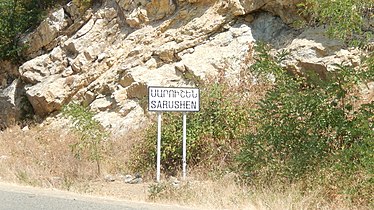 Sign in Armenian reading "Sarushen"
 -
 WWII monument
 -
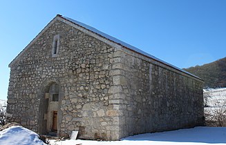 Pirumashen Church
.jpg)
.jpg)

References
- ^ a b c d Hakob Ghahramanyan. "Directory of socio-economic characteristics of NKR administrative-territorial units (2015)".
- ^ Андрей Зубов. "Андрей Зубов. Карабах: Мир и Война". drugoivzgliad.com.
- ^ "The Churches of Artsakh". St. Nersess Armenian Seminary.
- ^ "The Results of the 2005 Census of the Nagorno-Karabakh Republic" (PDF). National Statistic Service of the Republic of Artsakh.
External links
Capital: Askeran | ||
| Urban communities |  | |
| Rural communities |
| |
| Not under Artsakh control | ||
