
Satilla, Georgia
Satilla, Georgia | |
|---|---|
 Satilla  Satilla | |
| Coordinates: 31°47′15″N 82°34′04″W / 31.78750°N 82.56778°W | |
| Country | United States |
| State | Georgia |
| County | Jeff Davis |
| Area | |
| • Total | 3.08 sq mi (7.98 km2) |
| • Land | 3.06 sq mi (7.93 km2) |
| • Water | 0.02 sq mi (0.05 km2) |
| Elevation | 230 ft (70 m) |
| Population (2020) | |
| • Total | 487 |
| • Density | 159.10/sq mi (61.43/km2) |
| Time zone | UTC-5 (Eastern (EST)) |
| • Summer (DST) | UTC-4 (EDT) |
| ZIP code | 31539[2] |
| Area code | 912 |
| GNIS feature ID | 332985[3] |
Satilla is a unincorporated community and census designated place in Jeff Davis County, Georgia, United States. Its population was 487 as of the 2020 census. U.S. Route 23 passes through the community.
Demographics[edit]
| Census | Pop. | Note | %± |
|---|---|---|---|
| 2010 | 421 | — | |
| 2020 | 487 | 15.7% | |
| U.S. Decennial Census[4] 1850-1870[5] 1870-1880[6] 1890-1910[7] 1920-1930[8] 1940[9] 1950[10] 1960[11] 1970[12] 1980[13] 1990[14] 2000[15] 2010[16] 2020[17] | |||
Saltilla first appeared as a census designated place in the 2010 U.S. Census.[16][15]
| Race / Ethnicity (NH = Non-Hispanic) | Pop 2010[16] | Pop 2020[17] | % 2010 | 2020 |
|---|---|---|---|---|
| White alone (NH) | 379 | 387 | 90.02% | 79.47% |
| Black or African American alone (NH) | 5 | 18 | 1.19% | 3.70% |
| Native American or Alaska Native alone (NH) | 1 | 1 | 0.24% | 0.21% |
| Asian alone (NH) | 5 | 2 | 1.19% | 0.41% |
| Pacific Islander alone (NH) | 0 | 0 | 0.00% | 0.00% |
| Some Other Race alone (NH) | 0 | 1 | 0.00% | 0.21% |
| Mixed Race or Multi-Racial (NH) | 0 | 18 | 0.00% | 3.70% |
| Hispanic or Latino (any race) | 31 | 60 | 7.36% | 12.32% |
| Total | 421 | 487 | 100.00% | 100.00% |
References[edit]
- ^ "2020 U.S. Gazetteer Files". United States Census Bureau. Retrieved December 18, 2021.
- ^ "Satilla ZIP Code". zipdatamaps.com. 2023. Retrieved January 12, 2023.
- ^ "Satilla". Geographic Names Information System. United States Geological Survey, United States Department of the Interior.
- ^ "Decennial Census of Population and Housing by Decade". US Census Bureau.
- ^ "1870 Census of Population - Georgia - Population of Civil Divisions less than Counties" (PDF). US Census Bureau. 1870.
- ^ "1880 Census of Population - Georgia - Population of Civil Divisions less than Counties" (PDF). US Census Bureau. 1880.
- ^ "1910 Census of Population - Georgia" (PDF). US Census Bureau. 1930.
- ^ "1930 Census of Population - Georgia" (PDF). US Census Bureau. 1930. p. 251-256.
- ^ "1940 Census of Population - Georgia" (PDF). US Census Bureau. 1940.
- ^ "1950 Census of Population - Georgia" (PDF). US Census Bureau. 1980.
- ^ "1960 Census of Population - Population of County Subdivisions - Georgia" (PDF). US Census Bureau. 1960.
- ^ "1970 Census of Population - Population of County Subdivisions - Georgia" (PDF). US Census Bureau. 1970.
- ^ "1980 Census of Population - Number of Inhabitants - Georgia" (PDF). US Census Bureau. 1980.
- ^ "1990 Census of Population - Summary Social, Economic, and Housing Characteristics - Georgia" (PDF). US Census Bureau. 1990.
- ^ a b "2000 Census of Population - General Population Characteristics - Georgia" (PDF). US Census Bureau. 2000.
- ^ a b c "P2 Hispanic or Latino, and Not Hispanic or Latino by Race – 2010: DEC Redistricting Data (PL 94-171) – Satilla CDP, Georgia". United States Census Bureau.
- ^ a b "P2 Hispanic or Latino, and Not Hispanic or Latino by Race – 2020: DEC Redistricting Data (PL 94-171) – Satilla CDP, Georgia". United States Census Bureau.
Municipalities and communities of Jeff Davis County, Georgia, United States | ||
|---|---|---|
| Cities | 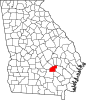 | |
| CDP | ||
| Unincorporated community | ||
| Ghost town | ||
This Jeff Davis County, Georgia state location article is a stub. You can help Wikipedia by expanding it. |