Jump to content

Selebar

Coordinates: 3°54′17″S 102°19′13″E / 3.90472°S 102.32028°E / -3.90472; 102.32028
From Wikipedia, the free encyclopedia

This is the current revision of this page, as edited by OktaRama2010 (talk | contribs) at 19:19, 1 March 2022. The present address (URL) is a permanent link to this version.

(diff) ← Previous revision | Latest revision (diff) | Newer revision → (diff)
Selebar
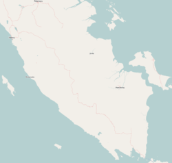
Selebar is located in Southern Sumatra
Selebar
Selebar
Location in Southern Sumatra
Selebar is located in Indonesia
Selebar
Selebar
Location in Indonesia
Coordinates: 3°54′17″S 102°19′13″E / 3.90472°S 102.32028°E / -3.90472; 102.32028
Country Indonesia
RegionSumatra
ProvinceBengkulu
CityBengkulu
Time zoneUTC+7 (IWST)

Selebar is a small port town on the south-west coast of Sumatra, Indonesia. It is located several kilometres south of Bengkulu City and is noted for its large harbor. Administratively, Selebar forms a districts of Bengkulu province.

References

[edit]