
Sunndalsøra
Sunndalsøra | |
|---|---|
Village | |
 Sunndalsøra viewed from the mountain Litlkalkinn. The estuary of the river Driva is clearly visible, as is the aluminium plant. The Sunndalsfjord stretches out to northwest towards Kristiansund | |
 Sunndalsøra Location in Møre og Romsdal  Sunndalsøra Sunndalsøra (Norway) | |
| Coordinates: 62°40′31″N 8°33′48″E / 62.6752°N 8.5633°E | |
| Country | Norway |
| Region | Western Norway |
| County | Møre og Romsdal |
| District | Nordmøre |
| Municipality | Sunndal Municipality |
| Area | |
| • Total | 3.39 km2 (1.31 sq mi) |
| Elevation | 6 m (20 ft) |
| Population (2018)[1] | |
| • Total | 4,054 |
| • Density | 1,196/km2 (3,100/sq mi) |
| Time zone | UTC+01:00 (CET) |
| • Summer (DST) | UTC+02:00 (CEST) |
| Post Code | 6600 Sunndalsøra |
Sunndalsøra (ⓘ) is the administrative centre of Sunndal Municipality in Møre og Romsdal county, Norway. The village of Sunndalsøra lies at the mouth of the river Driva at the beginning of the Sunndalsfjord. Sunndalsøra is surrounded by steep mountains, such as Hårstadnebba, which reach elevations as high as 1,700 metres (5,600 ft). Some of these mountains around Sunndalsøra are used for BASE jumping.
The 3.39-square-kilometre (840-acre) village has a population (2018) of 4,054 and a population density of 1,196 inhabitants per square kilometre (3,100/sq mi).[1]
Location[edit]
The village is located about 4 kilometres (2.5 mi) west of the village of Hoelsand, 10 kilometres (6.2 mi) southeast of the village of Øksendalsøra, and about 9 kilometres (5.6 mi) west of the village of Grøa. Norwegian National Road 70 runs through the village of Sunndalsøra on its way from the town of Kristiansund to Oppdal Municipality in the neighboring Trøndelag county.
Economy[edit]
Sunndalsøra is the largest village in Sunndal Municipality and it is home to Hov Church, the main church for the parish. Norsk Hydro operates an aluminium plant at Sunndalsøra. About 900 employees work at the plant, which has been operating since 1954. In 2004, the plant was modernized to become the biggest and among the most modern aluminium plants in Europe, greatly reducing pollution. In addition to aluminium related research, aquaculture research also takes place in Sunndalsøra, and many also work in public service in Sunndal municipality.[3]
Climate[edit]
Sunndalsøra has a temperate oceanic climate (Cfb). Atlantic lows can produce a strong foehn effect in winter. This occurs when there is a strong low located southwest of the coast bringing mild air from the Atlantic Ocean, and the air is further warmed when forced over the mountains, and a dry warm air comes down on the leeward side down to the fjord. Sunndalsøra has the national all-time high for all winter months: December with 18.3 °C (64.9 °F) recorded in 1998, January with 19.0 °C (66.2 °F), recorded January 2, 2020. This is also the warmest winter temperature ever recorded in Scandinavia. And in February with 18.9 °C (66.0 °F) recorded February 23, 1990.[4]
The record high 32.1 °C (89.8 °F) is from July 2014, and the record low −18.9 °C (−2.0 °F) is from February 2010.
| Climate data for Sunndalsøra 1991-2020 (6 m, extremes 1983-2020) | |||||||||||||
|---|---|---|---|---|---|---|---|---|---|---|---|---|---|
| Month | Jan | Feb | Mar | Apr | May | Jun | Jul | Aug | Sep | Oct | Nov | Dec | Year |
| Record high °C (°F) | 19 (66) |
18.9 (66.0) |
18.4 (65.1) |
22.2 (72.0) |
28.1 (82.6) |
31.2 (88.2) |
32.1 (89.8) |
31.7 (89.1) |
27.6 (81.7) |
25 (77) |
21.6 (70.9) |
18.3 (64.9) |
32.1 (89.8) |
| Mean daily maximum °C (°F) | 5.1 (41.2) |
4.3 (39.7) |
6.9 (44.4) |
10.7 (51.3) |
14.7 (58.5) |
17.6 (63.7) |
19.9 (67.8) |
19.4 (66.9) |
16 (61) |
10.8 (51.4) |
7.5 (45.5) |
5.1 (41.2) |
11.5 (52.7) |
| Daily mean °C (°F) | 1.6 (34.9) |
1.1 (34.0) |
2.9 (37.2) |
6.6 (43.9) |
10.2 (50.4) |
13.1 (55.6) |
15.5 (59.9) |
15.2 (59.4) |
12 (54) |
7.3 (45.1) |
4.3 (39.7) |
1.8 (35.2) |
7.6 (45.8) |
| Mean daily minimum °C (°F) | −1.2 (29.8) |
−1.6 (29.1) |
0.1 (32.2) |
3 (37) |
6.3 (43.3) |
9.4 (48.9) |
12 (54) |
11.9 (53.4) |
8.7 (47.7) |
4.4 (39.9) |
1.5 (34.7) |
−1.1 (30.0) |
4.4 (40.0) |
| Record low °C (°F) | −16.6 (2.1) |
−18.9 (−2.0) |
−16 (3) |
−6.3 (20.7) |
−1 (30) |
0.7 (33.3) |
4 (39) |
0.9 (33.6) |
−1.5 (29.3) |
−7.3 (18.9) |
−11.4 (11.5) |
−16.7 (1.9) |
−18.9 (−2.0) |
| Average precipitation mm (inches) | 92 (3.6) |
85 (3.3) |
79 (3.1) |
59 (2.3) |
58 (2.3) |
80 (3.1) |
73 (2.9) |
100 (3.9) |
95 (3.7) |
93 (3.7) |
89 (3.5) |
101 (4.0) |
1,004 (39.4) |
| Average precipitation days (≥ 1.0 mm) | 13 | 13 | 14 | 11 | 12 | 15 | 14 | 15 | 13 | 12 | 11 | 12 | 155 |
| Source 1: Norwegian Meteorological Institute[5] | |||||||||||||
| Source 2: Noaa WMO averages 91-2020 Norway [6] | |||||||||||||
Old climate normal
| Climate data for Sunndalsøra 1960-1990 | |||||||||||||
|---|---|---|---|---|---|---|---|---|---|---|---|---|---|
| Month | Jan | Feb | Mar | Apr | May | Jun | Jul | Aug | Sep | Oct | Nov | Dec | Year |
| Record high °C (°F) | 19.0 (66.2) |
18.9 (66.0) |
18.4 (65.1) |
22.2 (72.0) |
28.1 (82.6) |
31.2 (88.2) |
32.1 (89.8) |
31.7 (89.1) |
27.6 (81.7) |
25 (77) |
21.6 (70.9) |
18.3 (64.9) |
32.1 (89.8) |
| Mean daily maximum °C (°F) | 2 (36) |
3 (37) |
4 (39) |
9 (48) |
13 (55) |
16 (61) |
18 (64) |
17 (63) |
14 (57) |
9 (48) |
5 (41) |
3 (37) |
9 (49) |
| Mean daily minimum °C (°F) | −2 (28) |
−2 (28) |
−1 (30) |
2 (36) |
6 (43) |
9 (48) |
12 (54) |
11 (52) |
8 (46) |
4 (39) |
1 (34) |
−1 (30) |
4 (39) |
| Record low °C (°F) | −16.6 (2.1) |
−18.9 (−2.0) |
−16 (3) |
−6.3 (20.7) |
−1 (30) |
0.7 (33.3) |
4 (39) |
0.9 (33.6) |
−1.5 (29.3) |
−7.3 (18.9) |
−11.4 (11.5) |
−16.7 (1.9) |
−18.9 (−2.0) |
| Average precipitation mm (inches) | 77 (3.0) |
62 (2.4) |
72 (2.8) |
55 (2.2) |
51 (2.0) |
60 (2.4) |
89 (3.5) |
86 (3.4) |
112 (4.4) |
102 (4.0) |
93 (3.7) |
102 (4.0) |
961 (37.8) |
| Average precipitation days | 10 | 9 | 10 | 9 | 8 | 11 | 13 | 13 | 14 | 12 | 11 | 13 | 133 |
| Source 1: Storm.no[7] | |||||||||||||
| Source 2: Eklima/met.no[8] | |||||||||||||
Media gallery[edit]
-
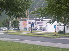 Rema 1000 in Sunndalsøra
 -
-

-

-
 Looking towards the village from the fjord
 -
 Bridge in Sunndalsøra


References[edit]
- ^ a b c Statistisk sentralbyrå (1 January 2018). "Urban settlements. Population and area, by municipality".
- ^ "Sunndalsøra, Sunndal (Møre og Romsdal)". yr.no. Retrieved 27 April 2019.
- ^ Store norske leksikon. "Sunndalsøra" (in Norwegian). Retrieved 25 April 2013.
- ^ "Norway records warmest ever January day at 19C". BBC News. 2 January 2020.
- ^ "Meteorologisk institutt". Norwegian Meteorological Institute (in English and Norwegian). Archived from the original on 5 July 2023. Retrieved 25 July 2023.
- ^ "NOAA WMO normals Norway 1991-2020".
- ^ "Sunndalsøra average conditions; base period 10 last years". Storm Weather Center. Retrieved 17 September 2016.
- ^ "Eklima/met.no database". Norwegian Meteorological Institute. Retrieved 17 September 2016.[permanent dead link]
External links[edit]
 Media related to Sunndalsøra at Wikimedia Commons