
Sweet Grass, Montana
Sweetgrass, Montana | |
|---|---|
 Topographical map of the Sweet Grass area | |
| Country | United States |
| State | Montana |
| County | Toole |
| Area | |
| • Total | 0.48 sq mi (1.25 km2) |
| • Land | 0.48 sq mi (1.25 km2) |
| • Water | 0.00 sq mi (0.00 km2) |
| Population (2020) | |
| • Total | 65 |
| • Density | 134.58/sq mi (51.94/km2) |
| FIPS code | 30-73075 |
| GNIS feature ID | 777367[2] |
Sweet Grass (also Sweetgrass[3]) is a census-designated place and unincorporated community in Toole County, Montana, United States, on the Canada–US border. It is the northern terminus of Interstate 15, an important route connecting western Canada, the western United States, and Mexico. The population was 65 according to the 2020 census.[4]
In 2004, a joint border facility opened at the Sweetgrass port of entry and Coutts, Alberta, housing both Canadian and American federal authorities.[5] At 3,540 feet (1,080 m) in elevation, it is one of the higher border crossings.
Fire service is provided through the volunteer fire department in Coutts.[6]
Demographics
| Census | Pop. | Note | %± |
|---|---|---|---|
| 2020 | 65 | — | |
| U.S. Decennial Census[7] | |||
Climate
Sweet Grass has a semi-arid climate (Köppen BSk) that closely borders a humid continental climate (Köppen Dwb).
| Climate data for Sweet Grass, Montana | |||||||||||||
|---|---|---|---|---|---|---|---|---|---|---|---|---|---|
| Month | Jan | Feb | Mar | Apr | May | Jun | Jul | Aug | Sep | Oct | Nov | Dec | Year |
| Record high °F (°C) | 64 (18) |
70 (21) |
72 (22) |
84 (29) |
91 (33) |
96 (36) |
105 (41) |
105 (41) |
95 (35) |
88 (31) |
74 (23) |
67 (19) |
105 (41) |
| Mean daily maximum °F (°C) | 31 (−1) |
35 (2) |
43 (6) |
54 (12) |
65 (18) |
73 (23) |
82 (28) |
81 (27) |
70 (21) |
57 (14) |
40 (4) |
31 (−1) |
55 (13) |
| Mean daily minimum °F (°C) | 8 (−13) |
12 (−11) |
20 (−7) |
30 (−1) |
39 (4) |
47 (8) |
52 (11) |
50 (10) |
42 (6) |
31 (−1) |
19 (−7) |
10 (−12) |
30 (−1) |
| Record low °F (°C) | −39 (−39) |
−35 (−37) |
−29 (−34) |
−7 (−22) |
16 (−9) |
30 (−1) |
35 (2) |
30 (−1) |
12 (−11) |
−12 (−24) |
−26 (−32) |
−44 (−42) |
−44 (−42) |
| Average precipitation inches (mm) | 0.30 (7.6) |
0.23 (5.8) |
0.58 (15) |
1.00 (25) |
2.61 (66) |
3.13 (80) |
1.96 (50) |
1.94 (49) |
1.45 (37) |
0.62 (16) |
0.45 (11) |
0.30 (7.6) |
14.57 (370) |
| Average snowfall inches (cm) | 9.5 (24) |
8.3 (21) |
8.9 (23) |
6.6 (17) |
2.3 (5.8) |
0.4 (1.0) |
0.1 (0.25) |
0.1 (0.25) |
2.6 (6.6) |
4.2 (11) |
7.4 (19) |
9.1 (23) |
59.5 (151.9) |
| Source: [8] | |||||||||||||
Notable people
- Earl W. Bascom (1906-1995), "Father of Modern Rodeo" and Hall of Fame Cowboy, artist, sculptor, actor, inventor, cowboyed in the 1920s on a ranch on Kicking Horse Creek once owned by his cousin C.M. Russell
- Charles M. Russell (1864-1926), cowboy artist and sculptor ranched on Kicking Horse Creek near the Sweetgrass Hills
In popular culture
- The town is referenced in the Marias Pass Approach/Route for TRS2006, via two portals on a BNSF Railway line that goes up to Sweet Grass.
- Referenced to in "Alberta Bound" by Paul Brandt. ("... and so I cranked up the radio cause there’s just a little more to go for I’d cross the border at that Sweet Grass sign.")
Notes
- ^ "ArcGIS REST Services Directory". United States Census Bureau. Retrieved September 18, 2022.
- ^ U.S. Geological Survey Geographic Names Information System: Sweet Grass, Montana
- ^ U.S. Geological Survey Geographic Names Information System: Sweet Grass, Montana
- ^ "Explore Census Data". data.census.gov. Retrieved 2022-06-26.
- ^ "Archived copy". Archived from the original on 2007-10-25. Retrieved 2007-06-03.
{{cite web}}: CS1 maint: archived copy as title (link) - ^ Dryden, Joel (30 January 2022). "Alberta premier says massive blockade preventing access to U.S. border 'must end'". cbc.ca. Archived from the original on 30 January 2022.
- ^ "Census of Population and Housing". Census.gov. Retrieved June 4, 2016.
- ^ "Intellicast | Weather Underground".
48°59′37″N 111°57′04″W / 48.99360°N 111.95118°W
Municipalities and communities of Toole County, Montana, United States | ||
|---|---|---|
| City | 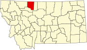 | |
| Towns | ||
| CDPs | ||
| Other communities | ||
This Toole County, Montana state location article is a stub. You can help Wikipedia by expanding it. |