
Sławików
Sławików | |
|---|---|
Village | |
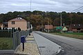
 Road to the church | |
 Sławików | |
| Coordinates: 50°11′6″N 18°13′18″E / 50.18500°N 18.22167°E | |
| Country | |
| Voivodeship | Silesian |
| County | Racibórz |
| Gmina | Rudnik |
| Population | 500 |
Sławików [swaˈvikuf] is a village in the administrative district of Gmina Rudnik, within Racibórz County, Silesian Voivodeship, in southern Poland.[1] It lies approximately 7 kilometres (4 mi) north-east of Rudnik, 12 km (7 mi) north of Racibórz, and 56 km (35 mi) west of the regional capital Katowice.
Gallery[edit]
-
 Church
 -
 Cross
Cross -
 Houses


References[edit]
Wikimedia Commons has media related to Sławików.
| Seat | _COA.svg) | |
|---|---|---|
| Other villages | ||
This Racibórz County location article is a stub. You can help Wikipedia by expanding it. |