
Townley, Alabama
Townley, Alabama | |
|---|---|
 Townley Location in Alabama  Townley Location in the United States | |
| Coordinates: 33°49′44″N 87°25′54″W / 33.82899°N 87.43167°W | |
| Country | United States |
| State | Alabama |
| County | Walker |
| Elevation | 338 ft (103 m) |
| Time zone | UTC-6 (Central (CST)) |
| • Summer (DST) | UTC-5 (CDT) |
| ZIP code | 35587[1] |
| Area code(s) | 205 and 659 |
Townley is an unincorporated community in Walker County, Alabama, United States.[2] It was formerly an incorporated town from 1895 until the 1920s. Townley has one site on the National Register of Historic Places, Boshell's Mill.[3]
Demographics[edit]
| Census | Pop. | Note | %± |
|---|---|---|---|
| 1900 | 124 | — | |
| 1910 | 235 | 89.5% | |
| 1920 | 1,554 | 561.3% | |
| U.S. Decennial Census[4] | |||
Townley, a coal-mining town, was initially incorporated in 1895.[5] It appeared on the next three consecutive U.S. Censuses, reaching its zenith in 1920, when it became the 4th largest town[6] in Walker County, with 1,554 residents. At some point after 1920 the coal mine shut down and the town either disincorporated or lost its charter, and has not appeared on census rolls since.
Geography[edit]
Townley is located at an elevation of 338 feet (103 m).[2] Its geographical location is in Walker County, Alabama, United States, North America [7]
Notable people[edit]
- Tom Bevill, Democratic fifteen-term U.S. congressman who represented Alabama's 4th Congressional District and Alabama's 7th congressional district from 1967 to 1997
- Carter Manasco, U.S. Representative from 1941 to 1949
References[edit]
- ^ "Townley ZIP Code". zipdatamaps.com. 2022. Retrieved November 11, 2022.
- ^ a b U.S. Geological Survey Geographic Names Information System: Townley, Alabama
- ^ "National Register Information System". National Register of Historic Places. National Park Service. July 9, 2010.
- ^ "U.S. Decennial Census". Census.gov. Retrieved June 6, 2013.
- ^ "Thomas Mathew Cranford".
- ^ 1830-2010 U.S. Censuses research on Walker County, Alabama communities
- ^ "Townley Map | United States Google Satellite Maps".
Municipalities and communities of Walker County, Alabama, United States | ||
|---|---|---|
| Cities | 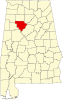 | |
| Towns | ||
| Unincorporated communities | ||
| Footnotes | ‡This populated place also has portions in an adjacent county or counties | |
This Walker County, Alabama state location article is a stub. You can help Wikipedia by expanding it. |