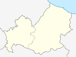
Venafrum
| Location | Comune di Venafro |
|---|---|
| Region | Campania |
| Coordinates | 41°29′08″N 14°02′23″E / 41.48556°N 14.03972°E |
| Type | Settlement |
| History | |
| Periods | Roman Republic |
| Cultures | Ancient Rome |
| Site notes | |
| Excavation dates | yes |
Venafrum was an ancient town of Molise, Italy, close to the boundaries of both Latium adiectum and Samnium. Its site is occupied by the modern Venafro, a village on the railway from Isernia to Vairano, 25 km southwest of the former, 201 m above sea-level.[1][2]
Overview
Venafrum was established as a civitas sine suffragio in 201 BC.[3] Ancient authors tell us but little about it, except that it was one of those towns governed by a prefect sent yearly from Rome, and that in the Social War it was taken by the allies by treachery. Augustus founded a colony there and provided for the construction of an aqueduct (cf. the long decree relating to it in Corp. Inscr. Lat. x. No. 4842).[1]
It seems to have been a place of some importance. Its olive oil was the best in Italy, and Cato mentions its brickworks and iron manufactures. The original line of the Via Latina probably ran through Venafrum, making a detour, which the later road seems to have avoided. Rufrae was probably dependent on it. Roads also ran from Venafrum to Isernia and to Telesia by way of Allifae.[1]
References
- ^ a b c One or more of the preceding sentences incorporates text from a publication now in the public domain: Ashby, Thomas (1911). "Venafrum". In Chisholm, Hugh (ed.). Encyclopædia Britannica. Vol. 27 (11th ed.). Cambridge University Press. p. 980.
- ^ Sylvia Diebner (1979). Aesernia-Venafrum: Tafeln. G. Bretschneider. ISBN 9788885007277.
- ^ Marta Conventi (2004). Città romane di fondazione. L'ERMA di BRETSCHNEIDER. pp. 60–. ISBN 978-88-8265-285-2.
External links
- Purcell, N., R. Talbert, T. Elliott, S. Gillies (2 December 2021). "Places: 433185 (Venafrum)". Pleiades. Retrieved March 8, 2012.
{{cite web}}: CS1 maint: multiple names: authors list (link)

