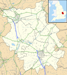
Warboys and Wistow Woods
| Site of Special Scientific Interest | |
 | |
| Location | Cambridgeshire |
|---|---|
| Grid reference | TL 300 818[1] |
| Coordinates | 52°25′08″N 0°05′24″W / 52.419°N 0.090°W |
| Interest | Biological |
| Area | 44.5 hectares[1] |
| Notification | 1983[1] |
Warboys and Wistow Woods is a 44.5 hectare biological Site of Special Scientific Interest north of Warboys and west of Wistow in Cambridgeshire.[1][2] Wistow Wood is an 8.5 hectare nature reserve owned and managed by the Wildlife Trust for Bedfordshire, Cambridgeshire and Northamptonshire.[3]
These woods have high conservation value because they are ancient ash and maple, and this habitat has sharply declined in extent since 1945. The woods have diverse flora and fauna, particularly invertebrates.[4]
There is access to Wistow Wood from Wistow Fen Lane, but Warboys Wood is private land with no public access.
References
- ^ a b c d "Designated Sites View: Warboys and Wistow Woods". Sites of Special Scientific Interest. Natural England. Retrieved 4 December 2016.
- ^ "Map of Warboys and Wistow Woods". Sites of Special Scientific Interest. Natural England. Retrieved 4 December 2016.
- ^ "Wistow Wood". Wildlife Trust for Bedfordshire, Cambridgeshire and Northamptonshire. Retrieved 4 December 2016.
- ^ "Warboys and Wistow Woods citation" (PDF). Sites of Special Scientific Interest. Natural England. Retrieved 4 December 2016.
External links
 Media related to Warboys and Wistow Woods at Wikimedia Commons

