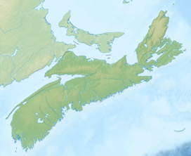
White Hill (Nova Scotia)
| White Hill | |
|---|---|
| Highest point | |
| Elevation | 532 m (1,745 ft) |
| Prominence | 535 m (1,755 ft) |
| Geography | |
| Location | Victoria County, |
| Region | CA |
| Parent range | Cape Breton Highlands |
| Topo map | NTS O11/K10 |
| Climbing | |
| Easiest route | Hike |
White Hill is a Canadian peak in the Cape Breton Highlands and is the highest elevation point in the province of Nova Scotia.
Located on the plateau 15 kilometres (9.3 mi) northwest of Ingonish and 30 kilometres (19 mi) northeast of Cheticamp, the peak is situated in the Cape Breton Highlands National Park and is accessible only by hiking.

