
Khnatsakh, Nagorno-Karabakh
Khnatsakh / Khanyurdu
Խնածախ / Xanyurdu | |
|---|---|
 | |
 Khnatsakh / Khanyurdu  Khnatsakh / Khanyurdu | |
| Coordinates: 39°50′49″N 46°44′20″E / 39.84694°N 46.73889°E | |
| Country | |
| • District | Khojaly |
| Population (2015)[1] | |
| • Total | 684 |
| Time zone | UTC+4 (AZT) |
Khnatsakh (Armenian: Խնածախ) or Khanyurdu (Azerbaijani: Xanyurdu) is a village in the Khojaly District of Azerbaijan. Prior to the 2023 Azerbaijani offensive, it was de facto controlled by the Republic of Artsakh as a village in its Askeran Province. The village has an ethnic Armenian-majority population, and also had an Armenian majority in 1989.[2] The village is located to the immediate north of the city of Stepanakert.
History[edit]

The modern village was founded in 1770 by settlers from the village of Khnatsakh in the Syunik region of Armenia.[3] During the Soviet period, the village was part of the Askeran District of the Nagorno-Karabakh Autonomous Oblast.
Historical heritage sites[edit]
Historical heritage sites in and around the village include the 12th/13th-century village of Kghategh (Armenian: Քղատեղ), a 13th-century khachkar, the 17th/18th-century shrine of Parur (Armenian: Պարուր), an 18th/19th-century cemetery, and the 19th-century church of Surb Astvatsatsin (Armenian: Սուրբ Աստվածածին, lit. 'Holy Mother of God').[1]
Economy and culture[edit]
The population is mainly engaged in agriculture and animal husbandry, as well as in different state institutions. As of 2015, the village has a municipal building, a house of culture, a secondary school, and a medical centre.[1]
Demographics[edit]
The village had 592 inhabitants in 2005,[4] and 684 inhabitants in 2015.[1]
Gallery[edit]
-
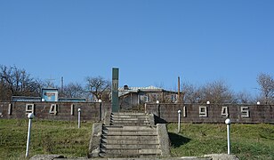 WWII monument
 -
 St. Astvatsatsin Church
 -
 Entrance to the village, sign reading "Khnatsakh" in Cyrillic script
 -
 Municipal building
 -
 School
 -
 Cemetery


References[edit]
- ^ a b c d Hakob Ghahramanyan. "Directory of socio-economic characteristics of NKR administrative-territorial units (2015)".
- ^ Андрей Зубов. "Андрей Зубов. Карабах: Мир и Война". drugoivzgliad.com.
- ^ Kiesling, Brady; Kojian, Raffi (2019). Rediscovering Armenia: An in-depth inventory of villages and monuments in Armenia and Artsakh (3rd ed.). Armeniapedia Publishing.
- ^ "The Results of the 2005 Census of the Nagorno-Karabakh Republic" (PDF). National Statistic Service of the Republic of Artsakh.
External links[edit]
Capital: Askeran | ||
| Urban communities |  | |
| Rural communities |
| |
| Not under Artsakh control | ||
