Bloomingville, Ohio

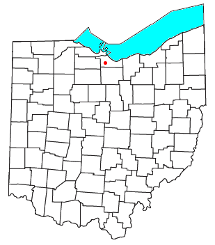
Bloomingville is an unincorporated community and census-designated place in northern Oxford Township, Erie County, Ohio, United States.[1] It is part of the Sandusky Metropolitan Statistical Area. Bloomingville is located at the intersection of Mason Road and Patten Tract Road. The Oxford Grange Hall located where Taylor Road forks off from Mason was the center of community life for many years.
The compact community consisted primarily of farmhouses clustered near the main intersection. Many of the farmhouses had working farms adjoining them or nearby. To the northeast lay an unused tract of 9,000 acres (36 km2) that had been the site of a World War II munitions factory. In 1957, NASA acquired part of this tract for its Plum Brook Station and by 1963 had acquired the rest of the tract to build additional facilities there.[2]
In 1984 a large golf course called Woussickett opened on Mason Road, west of Patten Tract Road.[citation needed]
The Erie Sand Barrens State Nature Preserve is located 1.4 miles east-northeast of Bloomingville on Scheid Road just off Taylor Road. The Sand Barrens are a remnant of Lake Warren, a glacial predecessor of today's Lake Erie.[3][4]
History
[edit]The first permanent settlement was made at Bloomingville in 1811 on the site of a former Indian camping ground.[5] Bloomingville was laid out in 1817.[6] A post office called Bloomingville was established in 1815, and remained in operation until 1906.[7]
References
[edit]- ^ U.S. Geological Survey Geographic Names Information System: Bloomingville, Ohio
- ^ History of NASA's Plum Brook Station Archived October 3, 2006, at the Wayback Machine
- ^ Ohio DNR: Erie Sand Barrens State Nature Preserve
- ^ Ohio Hometown Locator: Erie Sand Barrens State Nature Preserve
- ^ Aldrich, Lewis Cass (1889). History of Erie County Ohio: With Illustrations and Biographical Sketches of Some of Its Prominent Men and Pioneers. D. Mason & Company. pp. 512.
- ^ Williams, William W. (1879). History of the Fire Lands, Comprising Huron and Erie Counties, Ohio. Press of Leader Printing Company. pp. 467.
- ^ "Erie County". Jim Forte Postal History. Archived from the original on April 9, 2005. Retrieved January 2, 2016.
External links
[edit]41°21′18″N 82°43′38″W / 41.35500°N 82.72722°W

