Forget-me-not Lakes (Wyoming): Difference between revisions
Appearance
Content deleted Content added
→Climate change impacts: per source, previous wording could imply that Forget-Me-Not Lakes is sole origin |
→Climate change impacts: Actually, this looks a bit peripheral to the subject matter of this article; perhaps it could be included in the “Ecology” section of the Grand Teton National Park article. Additionally, the first two sentences appear to be a copyvio. |
||
| Line 34: | Line 34: | ||
}} |
}} |
||
'''Forget-me-not Lakes''' is a high elevation ecosystem located in [[Grand Teton National Park]], in the [[U. S. state]] of [[Wyoming]].<ref name=topo/> It is located {{convert|8.8|mi}} from Moose Wilson Road, in Teton County, and situated {{convert|1|mi}} west of [[Rimrock Lake (Wyoming)|Rimrock Lake]] and [[Prospectors Mountain]]. The lakes consist of several small bodies of water, the largest {{convert|150|yd|abbr=on}} long and {{convert|180|yd|abbr=on}} wide. Death Creek has 24 tributary streams, several of which originate from Death Shelf springs; two tributaries originate from Forget-Me-Not Lakes, elevation {{convert|9600|feet}} and Rimrock Lake {{convert|9915|feet}}<ref name=UofW>{{cite web|url= | title=Elevation gradients in aquatic invertebrate assemblages:Gathering baseline information in Grand Teton National Park’s high elevation streams and lakes | url=https://www.uwyo.edu/wyndd/_files/docs/reports/wynddreports/u14tro04wyus.pdf | publisher=Wyoming Natural Diversity Database, University of Wyoming | page=5 | date=2014 | access-date=September 3, 2022}}</ref><ref>{{cite web|url=https://www.nrc.gov/docs/ML1301/ML13016A388.pdf |title=Wyoming Surface Water Classification List | date=June 21, 2001 | access-date=September 3, 2022}}</ref> and are located in a remote area near the head of [[Death Canyon]] on the slopes of Prospectors Mountain.<ref>{{cite book |last1=Ortenburger |first1=Leigh |last2=Jackson |first2=Reynold |title=A Climber's Guide to the Teton Range |date=1996 |publisher=Mountaineers |isbn=9780898864809 |url=https://www.google.com/books/edition/A_Climber_s_Guide_to_the_Teton_Range/Z-Y1tLw_YWgC?hl=en&gbpv=1&dq=Forget-me-not+Lakes+death+canyon&pg=PA49&printsec=frontcover |access-date=August 21, 2022}}</ref> |
'''Forget-me-not Lakes''' is a high elevation ecosystem located in [[Grand Teton National Park]], in the [[U. S. state]] of [[Wyoming]].<ref name=topo/> It is located {{convert|8.8|mi}} from Moose Wilson Road, in Teton County, and situated {{convert|1|mi}} west of [[Rimrock Lake (Wyoming)|Rimrock Lake]] and [[Prospectors Mountain]]. The lakes consist of several small bodies of water, the largest {{convert|150|yd|abbr=on}} long and {{convert|180|yd|abbr=on}} wide. Death Creek has 24 tributary streams, several of which originate from Death Shelf springs; two tributaries originate from Forget-Me-Not Lakes, elevation {{convert|9600|feet}} and Rimrock Lake {{convert|9915|feet}}<ref name=UofW>{{cite web|url= | title=Elevation gradients in aquatic invertebrate assemblages:Gathering baseline information in Grand Teton National Park’s high elevation streams and lakes | url=https://www.uwyo.edu/wyndd/_files/docs/reports/wynddreports/u14tro04wyus.pdf | publisher=Wyoming Natural Diversity Database, University of Wyoming | page=5 | date=2014 | access-date=September 3, 2022}}</ref><ref>{{cite web|url=https://www.nrc.gov/docs/ML1301/ML13016A388.pdf |title=Wyoming Surface Water Classification List | date=June 21, 2001 | access-date=September 3, 2022}}</ref> and are located in a remote area near the head of [[Death Canyon]] on the slopes of Prospectors Mountain.<ref>{{cite book |last1=Ortenburger |first1=Leigh |last2=Jackson |first2=Reynold |title=A Climber's Guide to the Teton Range |date=1996 |publisher=Mountaineers |isbn=9780898864809 |url=https://www.google.com/books/edition/A_Climber_s_Guide_to_the_Teton_Range/Z-Y1tLw_YWgC?hl=en&gbpv=1&dq=Forget-me-not+Lakes+death+canyon&pg=PA49&printsec=frontcover |access-date=August 21, 2022}}</ref> |
||
==Climate change impacts== |
|||
It has been predicted that high elevation ecosystems will be strongly impacted by climate change. Invertebrates of high elevation streams and lakes have little area to move to in response to increasing temperatures; therefore, research has focused on the resident invertebrates of certain high elevation areas in the Grand Tetons, including Death Creek which is fed by around 24 tributaries, one of which originates in Forget-Me-Not Lakes.<ref name=UofW /> |
|||
==References== |
==References== |
||
{{reflist}} |
{{reflist}} |
||
Revision as of 13:32, 3 September 2022
This page is currently the subject of a deletion review. Those interested may participate in the discussion. While the discussion is in progress, this page may be edited, but do not blank, move, merge, redirect this page, or remove this notice from the page. |
| Forget-me-not Lakes | |
|---|---|
| Location | Grand Teton National Park, Teton County, Wyoming, US |
| Coordinates | 43°39′01″N 110°52′26″W / 43.65028°N 110.87389°W[1] |
| Lake type | Glacial lake |
| Basin countries | United States |
| Max. length | 150 yd (140 m) |
| Max. width | 180 yd (160 m) |
| Surface elevation | 9,581 ft (2,920 m)[2] |
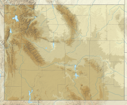
Forget-me-not Lakes is a high elevation ecosystem located in Grand Teton National Park, in the U. S. state of Wyoming.[2] It is located 8.8 miles (14.2 km) from Moose Wilson Road, in Teton County, and situated 1 mile (1.6 km) west of Rimrock Lake and Prospectors Mountain. The lakes consist of several small bodies of water, the largest 150 yd (140 m) long and 180 yd (160 m) wide. Death Creek has 24 tributary streams, several of which originate from Death Shelf springs; two tributaries originate from Forget-Me-Not Lakes, elevation 9,600 feet (2,900 m) and Rimrock Lake 9,915 feet (3,022 m)[3][4] and are located in a remote area near the head of Death Canyon on the slopes of Prospectors Mountain.[5]
References
- ^ "Forget-me-not Lakes". Geographic Names Information System. United States Geological Survey, United States Department of the Interior. Retrieved 2012-02-09.
- ^ a b Coyote Lake Topo Map in Teton County WY (Map). Topozone (USGS Quads). Retrieved August 22, 2022.
- ^ "Elevation gradients in aquatic invertebrate assemblages:Gathering baseline information in Grand Teton National Park's high elevation streams and lakes" (PDF). Wyoming Natural Diversity Database, University of Wyoming. 2014. p. 5. Retrieved September 3, 2022.
- ^ "Wyoming Surface Water Classification List" (PDF). June 21, 2001. Retrieved September 3, 2022.
- ^ Ortenburger, Leigh; Jackson, Reynold (1996). A Climber's Guide to the Teton Range. Mountaineers. ISBN 9780898864809. Retrieved August 21, 2022.


