Dalaffilla: Difference between revisions
No edit summary |
No edit summary |
||
| Line 21: | Line 21: | ||
Dalafilla is part of the Erta Ale Volcanic Segment in the northern [[Afar Region]] of Ethopia, which contains seven volcanoes including Alu, Dalafilla and Borale. It has a shallow gradient in its lower section, but the upper portion of the volcano is extremely steep.<ref name="g558">{{cite journal | last=Watts | first=Emma J. | last2=Gernon | first2=Thomas M. | last3=Taylor | first3=Rex N. | last4=Keir | first4=Derek | last5=Siegburg | first5=Melanie | last6=Jarman | first6=Jasmin | last7=Pagli | first7=Carolina | last8=Gioncada | first8=Anna | title=Evolution of the Alu-Dalafilla and Borale volcanoes, Afar, Ethiopia | journal=Journal of Volcanology and Geothermal Research | volume=408 | date=2020 | doi=10.1016/j.jvolgeores.2020.107094 | page=107094}}</ref> |
Dalafilla is part of the Erta Ale Volcanic Segment in the northern [[Afar Region]] of Ethopia, which contains seven volcanoes including Alu, Dalafilla and Borale. It has a shallow gradient in its lower section, but the upper portion of the volcano is extremely steep.<ref name="g558">{{cite journal | last=Watts | first=Emma J. | last2=Gernon | first2=Thomas M. | last3=Taylor | first3=Rex N. | last4=Keir | first4=Derek | last5=Siegburg | first5=Melanie | last6=Jarman | first6=Jasmin | last7=Pagli | first7=Carolina | last8=Gioncada | first8=Anna | title=Evolution of the Alu-Dalafilla and Borale volcanoes, Afar, Ethiopia | journal=Journal of Volcanology and Geothermal Research | volume=408 | date=2020 | doi=10.1016/j.jvolgeores.2020.107094 | page=107094}}</ref> |
||
The Global Volcanism Program describes the volcano's location as "a hot, arid, and desolate rift basin" that lies up to 100 meters below sea level. Few people live in the area, which has limited monitoring and scientific observation of the volcano. Initial reports of the 2008 eruption claimed a level of lava output that turned out to be 20 times too large. The location of the eruption was also erroneously thought to be further east than it really was, due to older and imprecise maps.<ref name="GVN2008">{{cite journal |editor-last=Wunderman |editor-first=Richard |date= October 2008 |title=Report on Alu-Dalafilla (Ethiopia) — October 2008 |url=https://volcano.si.edu/showreport.cfm?doi=10.5479/si.GVP.BGVN200810-221060 |journal=Bulletin of the Global Volcanism Network |volume=33 |issue=10 |location= |publisher= |access-date= 2024-06- |
The Global Volcanism Program describes the volcano's location as "a hot, arid, and desolate rift basin" that lies up to 100 meters below sea level. Few people live in the area, which has limited monitoring and scientific observation of the volcano. Initial reports of the 2008 eruption claimed a level of lava output that turned out to be 20 times too large. The location of the eruption was also erroneously thought to be further east than it really was, due to older and imprecise maps.<ref name="GVN2008">{{cite journal |editor-last=Wunderman |editor-first=Richard |date= October 2008 |title=Report on Alu-Dalafilla (Ethiopia) — October 2008 |url=https://volcano.si.edu/showreport.cfm?doi=10.5479/si.GVP.BGVN200810-221060 |journal=Bulletin of the Global Volcanism Network |volume=33 |issue=10 |location= |publisher= |access-date= 2024-06-20}}</ref> |
||
Dalafilla means "cut neck" in the [[Afar language|Afar]] language.<ref name="GVN2008"/> |
Dalafilla means "cut neck" in the [[Afar language|Afar]] language.<ref name="GVN2008"/> |
||
Revision as of 23:50, 20 June 2024
| Dalaffilla | |
|---|---|
| Highest point | |
| Elevation | 578 m (1,896 ft)[1] |
| Coordinates | 13°47′27″N 40°33′16″E / 13.79083°N 40.55444°E[1] |
| Geography | |
| Location | |
| Geology | |
| Mountain type | Stratovolcano with Fissure vents |
| Last eruption | 2008 |
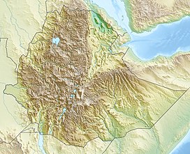
Dalaffilla, also called Gabuli, or Alu-Dalafilla is a 578 m (1,896 ft) high stratovolcano in Ethiopia. It is the highest point of Gulina. The only recorded eruption of Dalaffilla occurred in 2008 when lava flows from its western and northwestern flanks traveled to the northeast.[1]
Dalafilla is part of the Erta Ale Volcanic Segment in the northern Afar Region of Ethopia, which contains seven volcanoes including Alu, Dalafilla and Borale. It has a shallow gradient in its lower section, but the upper portion of the volcano is extremely steep.[2]
The Global Volcanism Program describes the volcano's location as "a hot, arid, and desolate rift basin" that lies up to 100 meters below sea level. Few people live in the area, which has limited monitoring and scientific observation of the volcano. Initial reports of the 2008 eruption claimed a level of lava output that turned out to be 20 times too large. The location of the eruption was also erroneously thought to be further east than it really was, due to older and imprecise maps.[3]
Dalafilla means "cut neck" in the Afar language.[3]
References
- ^ a b c "Alu-Dalafilla". Global Volcanism Program. Smithsonian Institution.
- ^ Watts, Emma J.; Gernon, Thomas M.; Taylor, Rex N.; Keir, Derek; Siegburg, Melanie; Jarman, Jasmin; Pagli, Carolina; Gioncada, Anna (2020). "Evolution of the Alu-Dalafilla and Borale volcanoes, Afar, Ethiopia". Journal of Volcanology and Geothermal Research. 408: 107094. doi:10.1016/j.jvolgeores.2020.107094.
- ^ a b Wunderman, Richard, ed. (October 2008). "Report on Alu-Dalafilla (Ethiopia) — October 2008". Bulletin of the Global Volcanism Network. 33 (10). Retrieved 2024-06-20.

