Orge: Difference between revisions
Appearance
Content deleted Content added
m Do general fixes and cleanup using AWB (8853) |
Greatgavini (talk | contribs) rv old vandalism |
||
| Line 15: | Line 15: | ||
*[http://sandre.eaufrance.fr/app/chainage/courdo/htm/F46-0400.php?cg=F46-0400 The Orge at the Sandre database] |
*[http://sandre.eaufrance.fr/app/chainage/courdo/htm/F46-0400.php?cg=F46-0400 The Orge at the Sandre database] |
||
[[ |
[[Category:Rivers of Île-de-France]] |
||
[[Category:Rivers of France]] |
[[Category:Rivers of France]] |
||
Revision as of 15:05, 9 January 2013
| Orge | |
|---|---|
 | |
| Physical characteristics | |
| Mouth | Seine 48°42′38″N 2°24′14″E / 48.71056°N 2.40389°E |
| Length | 53 km |
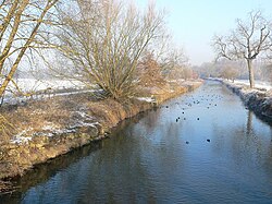
The Orge is a 53 km long river in France, left tributary of the Seine. Its source is in the village Saint-Martin-de-Bréthencourt. Its course crosses the départements of Yvelines and Essonne. It flows northwest through the towns of Dourdan, Saint-Chéron, Breuillet, Arpajon, and Savigny-sur-Orge, finally flowing into the Seine in Athis-Mons, south of Paris.
External links
