
File:EU map brown.svg

Size of this PNG preview of this SVG file: 454 × 450 pixels. Other resolutions: 242 × 240 pixels | 484 × 480 pixels | 775 × 768 pixels | 1,033 × 1,024 pixels | 2,066 × 2,048 pixels.
Original file (SVG file, nominally 454 × 450 pixels, file size: 712 KB)
| This is a file from the Wikimedia Commons. Information from its description page there is shown below. Commons is a freely licensed media file repository. You can help. |
Summary
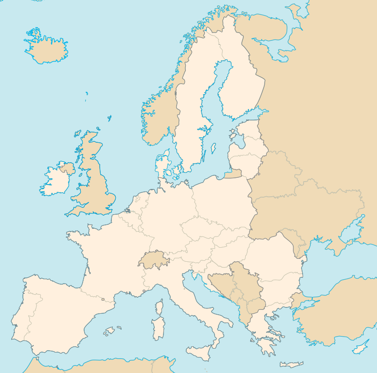
| Description | Map of the Member States of the European Union | ||
| Date | |||
| Source | Own work, File:Blank map europe.svg | ||
| Author | Ssolbergj | ||
| Permission (Reusing this file) |
I, the copyright holder of this work, hereby publish it under the following licenses: This file is licensed under the Creative Commons Attribution-Share Alike 3.0 Unported license.
You may select the license of your choice. |

File history
Click on a date/time to view the file as it appeared at that time.
| Date/Time | Thumbnail | Dimensions | User | Comment | |
|---|---|---|---|---|---|
| 20:06, 9 September 2007 |  | 454 × 450 (980 KB) | Ssolbergj | Reverted to version as of 20:05, 9 September 2007 | |
| 20:06, 9 September 2007 |  | 454 × 450 (980 KB) | Ssolbergj | ||
| 20:05, 9 September 2007 |  | 454 × 450 (980 KB) | Ssolbergj | ||
| 20:00, 9 September 2007 |  | 454 × 450 (521 KB) | Ssolbergj | ||
| 16:43, 2 May 2007 |  | 301 × 290 (816 KB) | Ssolbergj | ||
| 16:34, 2 May 2007 |  | 301 × 290 (816 KB) | Ssolbergj | ||
| 16:31, 2 May 2007 |  | 301 × 290 (816 KB) | Ssolbergj | ||
| 15:34, 1 May 2007 |  | 301 × 290 (814 KB) | Editor at Large | Tip of Turkey and Moldova not in EU, grouped objects | |
| 15:11, 1 May 2007 |  | 301 × 290 (809 KB) | Editor at Large | Fixed Moldova (was a body of water), removed content outside bounds of image, fixed up and removed border | |
| 16:28, 25 April 2007 |  | 301 × 290 (833 KB) | Ssolbergj | {{Inkscape}} |
File usage
The following pages on the English Wikipedia use this file (pages on other projects are not listed):
- User:Giandrea/EU Portal/Member states
- User:Pee Tern/Sandbox/Template/Infobox Law enforcement agency
- User:Pee Tern/Sandbox/Template/Infobox Law enforcement agency/doc
- User:Pee Tern/Sandbox/Template/Infobox Law enforcement agency/doc master
- User:Ssolbergj/Geographic Features of the European Union Labelled Map
- User:Ssolbergj/map
- Template:European Union Labelled Map (brown)
- Portal:European Union/Member States Intro
Global file usage
The following other wikis use this file:
- Usage on as.wikipedia.org
- Usage on be.wikipedia.org
- Usage on bh.wikipedia.org
- Usage on ca.wikipedia.org
- Usage on da.wikipedia.org
- Usage on es.wikipedia.org
- Usage on fa.wikipedia.org
- Usage on fr.wikipedia.org
- Office de l'Union européenne pour la propriété intellectuelle
- Eurojust
- Agence européenne de défense
- Autorité européenne de sécurité des aliments
- Observatoire européen des phénomènes racistes et xénophobes
- Agence européenne des médicaments
- Agence européenne pour l'environnement
- Institut d'études de sécurité de l'Union européenne
- Agence européenne pour la sécurité et la santé au travail
- Centre européen de prévention et de contrôle des maladies
- Agence européenne pour la gestion de la coopération opérationnelle aux frontières extérieures
- Association des autorités européennes de concurrence
- Agence européenne pour la sécurité maritime
- Modèle:Infobox Agence européenne
- Modèle:Carte membres de l'Union européenne
- Agence des droits fondamentaux de l'Union européenne
- États membres de l'Union européenne
- Agence européenne de contrôle des pêches
- Agence de l'Union européenne pour la cybersécurité
- Agence européenne pour la reconstruction
- Office communautaire des variétés végétales
- Centre européen pour le développement de la formation professionnelle
- Fondation européenne pour l'amélioration des conditions de vie et de travail
- Agence de l'Union européenne pour le programme spatial
- Agence de l'Union européenne pour la formation des services répressifs
- Centre satellitaire de l'Union européenne
- Centre de traduction des organes de l'Union européenne
- Géographie de l'Union européenne
- Fondation européenne pour la formation
- Institut européen pour l'égalité entre les hommes et les femmes
- Utilisateur:Y5005/modèle agence euro
- Utilisateur:Y5005/modèle agence euro/Documentation
- Modèle:Infobox Agence européenne/Documentation
- Autorité bancaire européenne
- Autorité européenne des marchés financiers
- Agence exécutive européenne pour le climat, les infrastructures et l’environnement
- Autorité européenne des assurances et des pensions professionnelles
View more global usage of this file.