
Category:United States Geological Survey images
| To place a file in this category, add the tag {{PD-USGov-Interior-USGS}} to the bottom of the file's description page. If you are not sure which category a file belongs to, consult the file copyright tag page. If this category is very large, please consider placing your file in a new or existing subcategory. Free files can be moved to the Wikimedia Commons. |
Media in category "United States Geological Survey images"
The following 52 files are in this category, out of 122 total.
(previous page) (next page)-
 Partnership Mansion 1936.png 1,144 × 703; 615 KB
-
 PequeaValleyArial.JPG 419 × 302; 35 KB
-
 Persea borbonia foliage and fruit (USGS photo).jpg 402 × 174; 15 KB
-
 Peter Pritchard.jpg 640 × 480; 43 KB
-
 Picture of the western sand darter.jpg 550 × 286; 68 KB
-
 PIEQF-02008.jpg 800 × 536; 130 KB
-
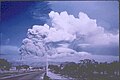 Pinatubo eruption cloud, 1991.jpg 731 × 487; 43 KB
-
 Platanthera-hyperborea1web.jpg 164 × 239; 33 KB
-
 Pleonaste.jpg 1,400 × 566; 541 KB
-
 PR Shaded Relief.jpg 2,147 × 873; 437 KB
-
 Pradodam.jpg 1,000 × 800; 485 KB
-
 PrairieRidgeHighSchool.png 669 × 867; 1.3 MB
-
 Psilomelane+Hausmanite.jpg 1,400 × 1,345; 767 KB
-
 Pumice-raft.jpg 539 × 332; 28 KB
-
 Pviridiscolor.PNG 346 × 288; 153 KB
-
 Pviridisinsubstrate.PNG 368 × 272; 258 KB
-
 Rameyafb-13oct1993.jpg 923 × 546; 141 KB
-
 Renner, TX 1974 Composite.png 2,924 × 1,380; 2.84 MB
-
 Retaining wall failure.jpeg 755 × 512; 50 KB
-
 SantaMonicaRail.jpg 1,000 × 800; 190 KB
-
 Seaviewsquare1995.png 408 × 384; 193 KB
-
 Seawall-large.jpg 450 × 296; 22 KB
-
 Silverado 1948.jpg 1,302 × 1,588; 336 KB
-
 South-central Los Angeles (aerial view).jpg 1,000 × 800; 131 KB
-
 Springhilltopo.png 328 × 263; 223 KB
-
 Star of Sierra Leone.gif 139 × 172; 7 KB
-
 SummerlandOilFieldCA.jpg 1,400 × 982; 594 KB
-
 Sunrise, Wyoming 1926.jpg 1,400 × 832; 649 KB
-
 SyracuseMuni NY 94.JPG 823 × 625; 82 KB
-
 Tallulah Falls.jpg 616 × 700; 329 KB
-
 Tallulah Falls2.jpg 572 × 700; 342 KB
-
 Tallulah Gorge (c, 1894)- USGS .jpg 555 × 700; 302 KB
-
 Thenardite,byu.jpg 700 × 352; 309 KB
-
 ThimbleIslandsConnecticut.png 345 × 468; 103 KB
-
 Tiawah aerial photo.png 799 × 600; 391 KB
-
 TownCreekMississippi1921.jpg 3,000 × 2,359; 978 KB
-
 Trimline1.gif 496 × 337; 160 KB
-
 Trinity3.jpg 870 × 741; 163 KB
-
 Triops anatomy en.jpg 974 × 647; 151 KB
-
 Turbidites.jpg 353 × 263; 14 KB
-
-
 TwinValleyHSarial.JPG 480 × 371; 54 KB
-
 USCGC Eastwind 3.jpg 861 × 633; 62 KB
-
 Usgs balboahs.jpg 558 × 705; 66 KB
-
 USGS M 6.7 - 29 km W of Imph?l, India ShakeMap Intensity.jpeg 787 × 996; 396 KB
-
 USGS modified from pierce, WG., and Rich, E.I. 1962.jpg 692 × 454; 198 KB
-
 Usgsdrillcore.jpg 400 × 300; 35 KB
-
 Usgsmanassa.JPG 400 × 300; 44 KB
-
 USGSseawall-lg.jpg 400 × 264; 20 KB
-
 Verbena simplex USGS.jpg 340 × 409; 34 KB
-
 View of Oakland Hills from Chabot Space & Science Center.jpg 800 × 600; 205 KB
-
 Ward and fossil tree trunks.jpg 666 × 788; 388 KB


.jpg)


.jpg)


-_USGS_.jpg)


