
Search results
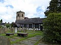 Peover. Ordnance Survey (2004), OS Explorer Map 257: Northwich & Delamere Forest, Southampton, United Kingdom: Ordnance Survey, ISBN 0-319-23567-X v t e...3 KB (170 words) - 13:04, 23 April 2021
 Forest (Map) (A1 ed.). 1:25000. Explorer. Ordnance Survey. 2004. ISBN 0-319-23567-X. "Community Governance Review of Burton and Duddon parishes, Notice...6 KB (509 words) - 16:49, 22 March 2021
 Forest (Map) (A1 ed.). 1:25000. Explorer. Ordnance Survey. 2004. ISBN 0-319-23567-X. "Other Walks in Cheshire". Cheshire County Council. Archived from the...3 KB (235 words) - 14:43, 14 July 2020
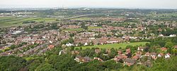 (1:25000 scale map). Southampton United Kingdom: Ordnance Survey. ISBN 0-319-23567-X. Phillips, A.D.M.; Phillips, C.B. (2002), A New Historical Atlas of...38 KB (3,461 words) - 16:58, 9 August 2024


