Chéché
Chéché | |
|---|---|
Village | |
| Coordinates: 11°55′39″N 14°12′52″W / 11.92750°N 14.21444°W | |
| Country | |
| Region | Gabú Region |
| Sector | Piche |
| Time zone | UTC+0 (GMT) |
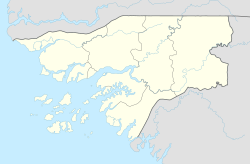
Chéché or Ché Ché is a village in the Gabú Region of north-eastern Guinea-Bissau. It lies on the south of the Corubal River, to the south of Canjadude.[citation needed] The river crossing was the site of the Cheche Disaster of 6 February 1969, in which about 50 Portuguese soldiers drowned in an accident when their ferry tipped over.[1]
References[edit]
- ^ Moura, Marlene (2010-02-18). "Desastre de Cheche: "Dignificar morte" de antigos combatentes". CiênciaHoje. Retrieved 2013-01-30.

