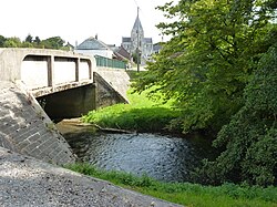
Thon (river)
Appearance
You can help expand this article with text translated from the corresponding article in French. (March 2011) Click [show] for important translation instructions.
|
| Thon | |
|---|---|
 | |
 | |
| Location | |
| Country | France |
| Physical characteristics | |
| Source | |
| • elevation | 273 m (896 ft) |
| Mouth | |
• location | Oise |
• coordinates | 49°54′20″N 3°54′30″E / 49.9055°N 3.9084°E |
| Length | 56.3 km (35.0 mi) |
| Basin features | |
| Progression | Oise→ Seine→ English Channel |
The Thon or Ton is a small river in northern France. It is a tributary of the river Oise, which flows into the Seine. It crosses the Ardennes and Aisne departments and is the central river of the Thiérache.[1]
References
[edit]
